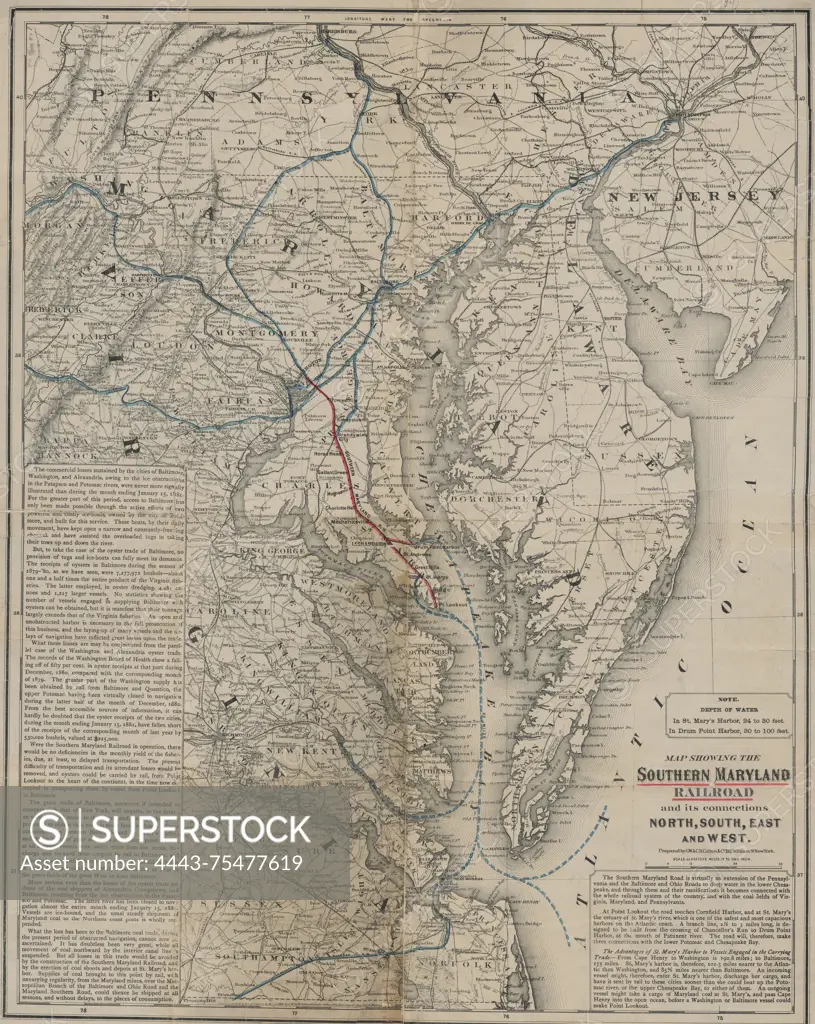
Map showing the Southern Maryland Railroad and its connections in all directions, dated 1881. Published by the Southern Maryland Railroad, the map focuses on railroads and steamboat lines in the Middle Atlantic States and Chesapeake Bay area. It is hand-colored and measures 56 x 44 cm, with the sheet size being 60 x 49 cm. The inferred place of publication is Washington, D.C
SuperStock offers millions of photos, videos, and stock assets to creatives around the world. This image of Map showing the Southern Maryland Railroad and its connections in all directions, dated 1881. Published by the Southern Maryland Railroad, the map focuses on railroads and steamboat lines in the Middle Atlantic States and Chesapeake Bay area. It is hand-colored and measures 56 x 44 cm, with the sheet size being 60 x 49 cm. The inferred place of publication is Washington, D.C by Artokoloro is available for licensing today.
Looking for a license?
Click here, and we'll help you find it! Questions? Just ask!
Click here, and we'll help you find it! Questions? Just ask!
DETAILS
Image Number: 4443-75477619Rights ManagedCredit Line:Artokoloro/SuperStockCollection:Artokoloro Model Release:NoProperty Release:NoResolution:4537×5700