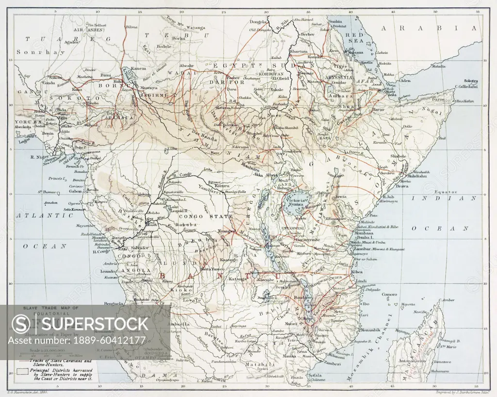
Map showing the slave trade areas and routes of equatorial Africa, created by Ernst Georg Ravenstein engraved by John Bartholomew. After a map in the book, Kiunangi: or, Story and History from Centr
SuperStock offers millions of photos, videos, and stock assets to creatives around the world. This image of Map showing the slave trade areas and routes of equatorial Africa, created by Ernst Georg Ravenstein engraved by John Bartholomew. After a map in the book, Kiunangi: or, Story and History from Centr by Ken Welsh/Design Pics is available for licensing today.
Looking for a license?
Click here, and we'll help you find it! Questions? Just ask!
Click here, and we'll help you find it! Questions? Just ask!
DETAILS
Image Number: 1889-60412177Rights ManagedCredit Line:Ken Welsh/Design Pics/SuperStockCollection:Design Pics Contributor:Ken Welsh Model Release:NoProperty Release:NoResolution:5197×4153