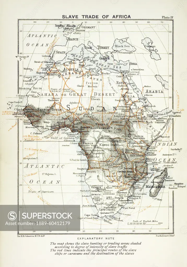
Map showing the slave trade in Africa and destinations of those captured. After a map created by Sir Harry Hamilton Johnston and engraved by John Bartholomew. It was published in Cambridge in 1899.
SuperStock offers millions of photos, videos, and stock assets to creatives around the world. This image of Map showing the slave trade in Africa and destinations of those captured. After a map created by Sir Harry Hamilton Johnston and engraved by John Bartholomew. It was published in Cambridge in 1899. by Ken Welsh/Design Pics is available for licensing today.
Looking for a license?
Click here, and we'll help you find it! Questions? Just ask!
Click here, and we'll help you find it! Questions? Just ask!
DETAILS
Image Number: 1889-60412179Rights ManagedCredit Line:Ken Welsh/Design Pics/SuperStockCollection:Design Pics Contributor:Ken Welsh Model Release:NoProperty Release:NoResolution:3553×5079