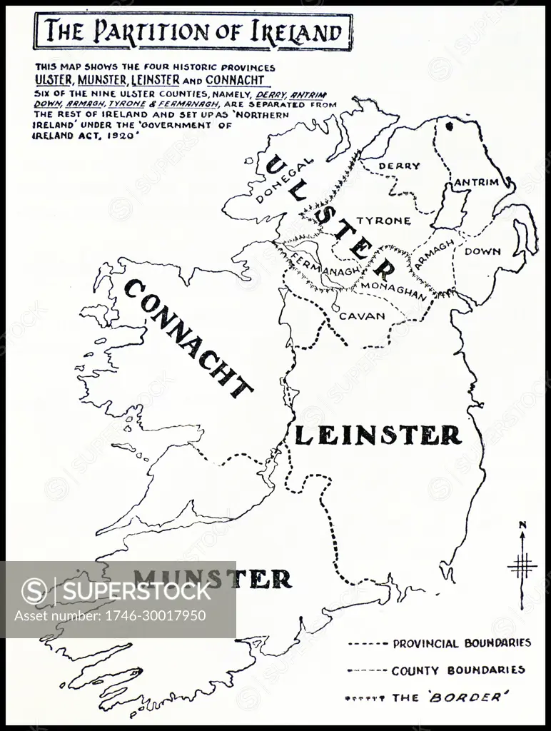
Map showing the partition of Ireland which led to Ireland being separated into two self-governing polities: Northern Ireland and Southern Ireland. It was enacted on 3 May 1921 under the Government of Ireland Act 1920.
SuperStock offers millions of photos, videos, and stock assets to creatives around the world. This image of Map showing the partition of Ireland which led to Ireland being separated into two self-governing polities: Northern Ireland and Southern Ireland. It was enacted on 3 May 1921 under the Government of Ireland Act 1920. by World History Archive/Image Asset Management is available for licensing today.
DETAILS
Image Number: 1746-30017950Rights ManagedCredit Line:World History Archive/Image Asset Management/SuperStockCollection:Image Asset Management Contributor:World History Archive Model Release:NoProperty Release:NoResolution:3977×5273
Free Research
Can't find the usage you need?
We're here to help!
Phone:+1 866 236 0087
Email: help@superstock.com
or fill out a Contact Form
Research / License Request Form
Can't find the usage you need?
We're here to help!
Phone:
or fill out a Contact Form
Research / License Request Form
Retouching Services
Our MediaMagnet division offers comprehensive retouching services at great rates. For a free quote, please send us an e-mail and we'll get back to you promptly.
Email: Retouching Service
Our MediaMagnet division offers comprehensive retouching services at great rates. For a free quote, please send us an e-mail and we'll get back to you promptly.
Email: Retouching Service