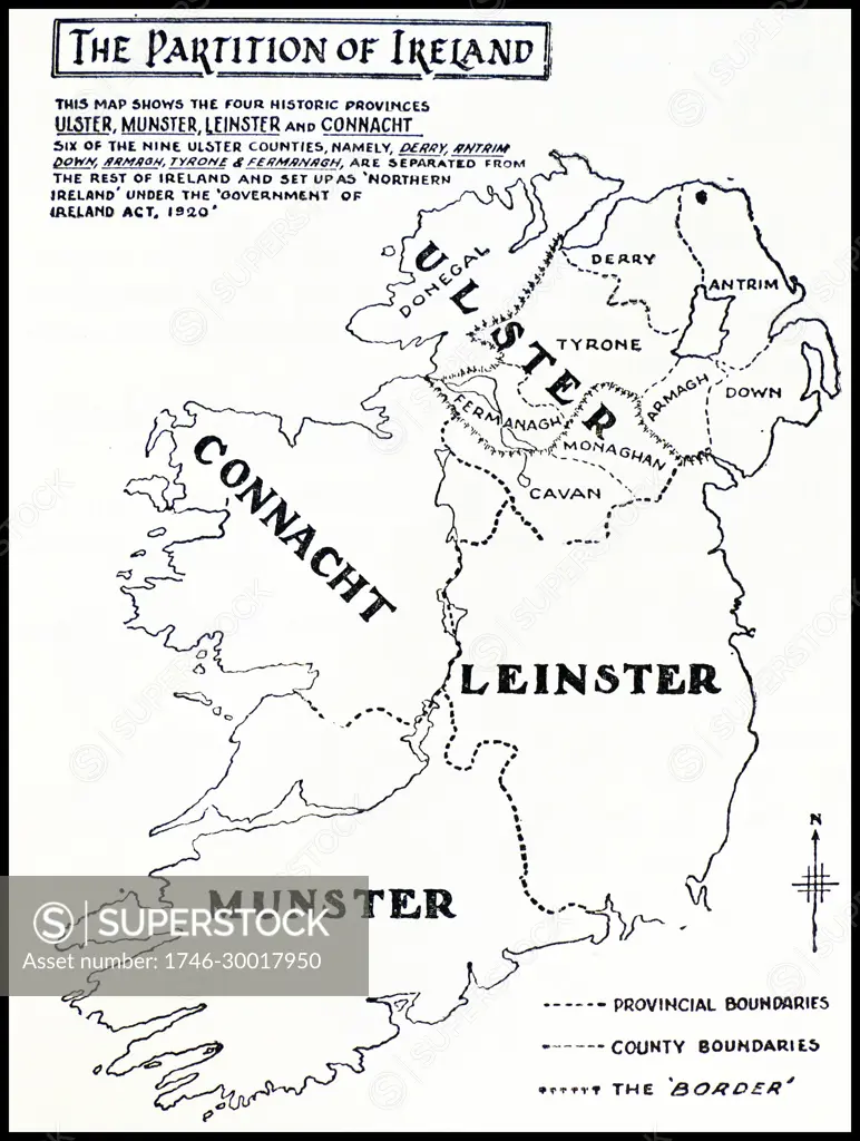
Map showing the partition of Ireland which led to Ireland being separated into two self-governing polities: Northern Ireland and Southern Ireland. It was enacted on 3 May 1921 under the Government of Ireland Act 1920.
SuperStock offers millions of photos, videos, and stock assets to creatives around the world. This image of Map showing the partition of Ireland which led to Ireland being separated into two self-governing polities: Northern Ireland and Southern Ireland. It was enacted on 3 May 1921 under the Government of Ireland Act 1920. by World History Archive/Image Asset Management is available for licensing today.
Looking for a license?
Click here, and we'll help you find it! Questions? Just ask!
Click here, and we'll help you find it! Questions? Just ask!
DETAILS
Image Number: 1746-30017950Rights ManagedCredit Line:World History Archive/Image Asset Management/SuperStockCollection:Image Asset Management Contributor:World History Archive Model Release:NoProperty Release:NoResolution:3977×5273