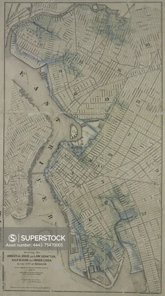
Map showing the original high and low grounds, salt marsh, and shorelines in the city of Brooklyn, based on original government surveys conducted in 1776-1777. Published by the Board of Health in 1876. The map is hand-colored and measures 69 x 38 cm. It provides insights into the historical geography of Brooklyn, New York
SuperStock offers millions of photos, videos, and stock assets to creatives around the world. This image of Map showing the original high and low grounds, salt marsh, and shorelines in the city of Brooklyn, based on original government surveys conducted in 1776-1777. Published by the Board of Health in 1876. The map is hand-colored and measures 69 x 38 cm. It provides insights into the historical geography of Brooklyn, New York by Artokoloro is available for licensing today.
Looking for a license?
Click here, and we'll help you find it! Questions? Just ask!
Click here, and we'll help you find it! Questions? Just ask!
DETAILS
Image Number: 4443-75470001Rights ManagedCredit Line:Artokoloro/SuperStockCollection:Artokoloro Model Release:NoProperty Release:NoResolution:3756×6706