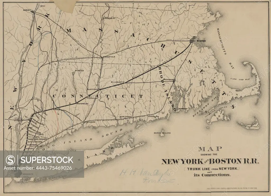
Map showing the New York and Boston R.R. (trunk line from New York) and its connections, 1870, 96 & 98 Fulton St., New York, Publisher, Ferd. Mayer & Sons, New York and Boston Railroad Company, Railroads, New England, Railroads, New York (State), Connecticut, Rhode Island, Massachusetts, Long Island (N.Y.), 1 map; 42 x 57 cm, sheet 48 x 63 cm
SuperStock offers millions of photos, videos, and stock assets to creatives around the world. This image of Map showing the New York and Boston R.R. (trunk line from New York) and its connections, 1870, 96 & 98 Fulton St., New York, Publisher, Ferd. Mayer & Sons, New York and Boston Railroad Company, Railroads, New England, Railroads, New York (State), Connecticut, Rhode Island, Massachusetts, Long Island (N.Y.), 1 map; 42 x 57 cm, sheet 48 x 63 cm by Artokoloro is available for licensing today.
Looking for a license?
Click here, and we'll help you find it! Questions? Just ask!
Click here, and we'll help you find it! Questions? Just ask!
DETAILS
Image Number: 4443-75469026Rights ManagedCredit Line:Artokoloro/SuperStockCollection:Artokoloro Model Release:NoProperty Release:NoResolution:5700×4127