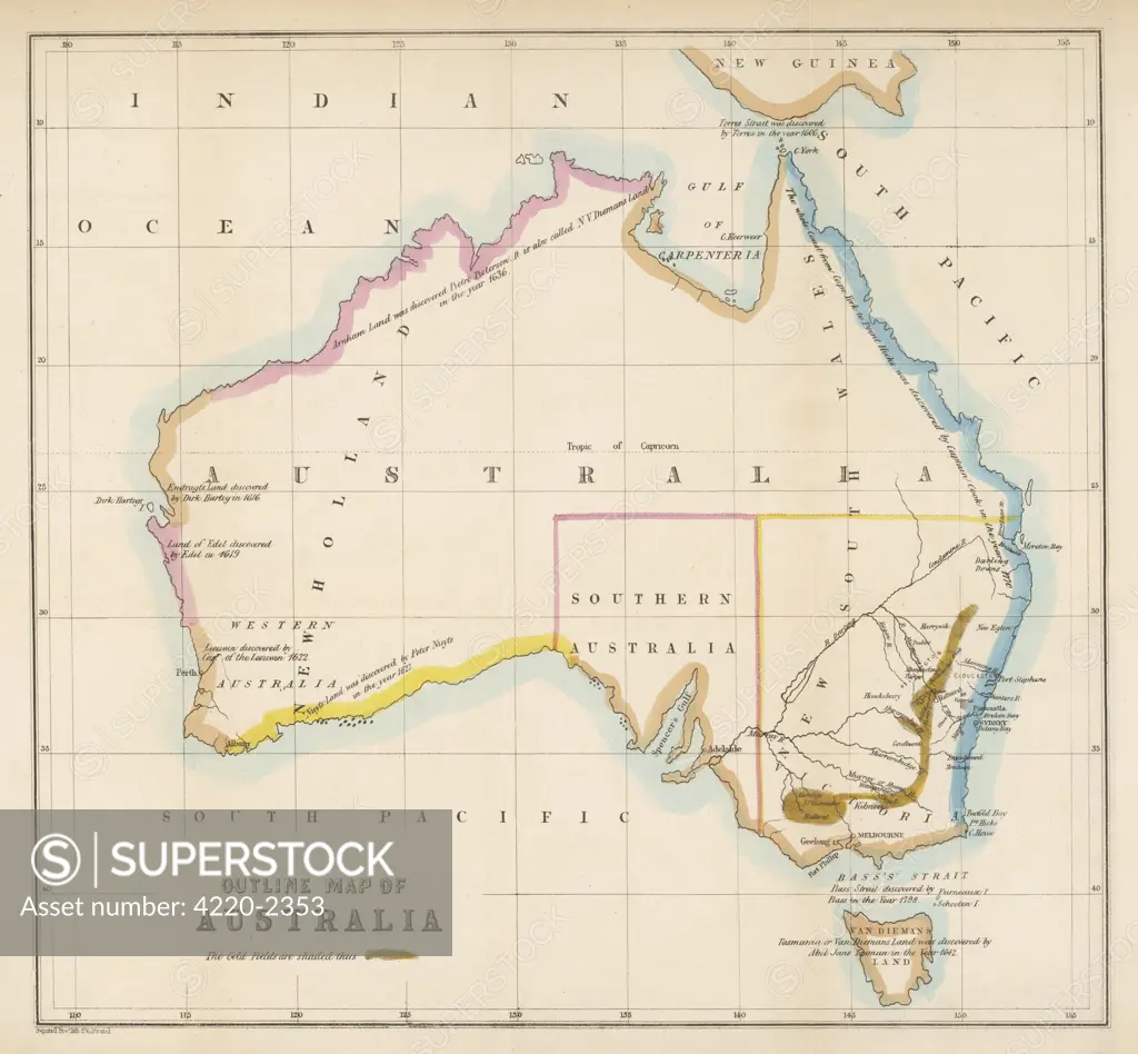
Map showing the location ofthe GOLDFIELDS, so presumablymade fairly soon after thestart of the Australian GoldRush in 1851Date: 1850s
SuperStock offers millions of photos, videos, and stock assets to creatives around the world. This image of Explore Historical Cartography: Vintage Outline Map of Australia Showcasing 19th-Century Geographical Insights by Mary Evans Picture Library/Pantheon is available for licensing today.
Looking for a license?
Click here, and we'll help you find it! Questions? Just ask!
Click here, and we'll help you find it! Questions? Just ask!
DETAILS
Image Number: 4220-2353Rights ManagedCredit Line:Mary Evans Picture Library/Pantheon/SuperStockCollection: