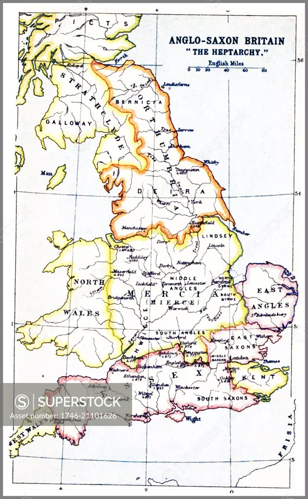
1914 Map showing the Heptarchy (from the Greek hepta, seven). The name applied to the Anglo-Saxon kingdoms of south, east, and central England during late antiquity and the early Middle Ages, conventionally identified as seven: Northumbria, Mercia, East Anglia, Essex, Kent, Sussex, and Wessex. The Anglo-Saxon kingdoms eventually unified into the Kingdom of England
SuperStock offers millions of photos, videos, and stock assets to creatives around the world. This image of 1914 Map showing the Heptarchy (from the Greek hepta, seven). The name applied to the Anglo-Saxon kingdoms of south, east, and central England during late antiquity and the early Middle Ages, conventionally identified as seven: Northumbria, Mercia, East Anglia, Essex, Kent, Sussex, and Wessex. The Anglo-Saxon kingdoms eventually unified into the Kingdom of England by Image Asset Management/World History Archive is available for licensing today.
Looking for a license?
Click here, and we'll help you find it! Questions? Just ask!
Click here, and we'll help you find it! Questions? Just ask!
DETAILS
Image Number: 1746-21101626Rights ManagedCredit Line:Image Asset Management/World History Archive/SuperStockCollection: