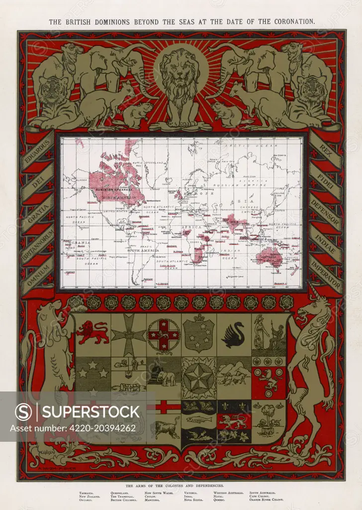
Map showing the extent of the British Empire in 1902 - the Empire on which the sun never sets ! Date: 1902
SuperStock offers millions of photos, videos, and stock assets to creatives around the world. This image of Historic Colonial Map: British Dominions at Coronation Era – Explore the expansive reach of the British Empire with this intricately detailed vintage map, showcasing global territories during the coronation period. Perfect for history enthusiasts and map collectors. by Illustrated London News Ltd/Mary Evans Picture Library/Pantheon is available for licensing today.
Looking for a license?
Click here, and we'll help you find it! Questions? Just ask!
Click here, and we'll help you find it! Questions? Just ask!
DETAILS
Image Number: 4220-20394262Rights ManagedCredit Line:Illustrated London News Ltd/Mary Evans Picture Library/Pantheon/SuperStockCollection:Mary Evans Picture Library Contributor:Illustrated London News Ltd Model Release:NoProperty Release:NoResolution:3091×4344