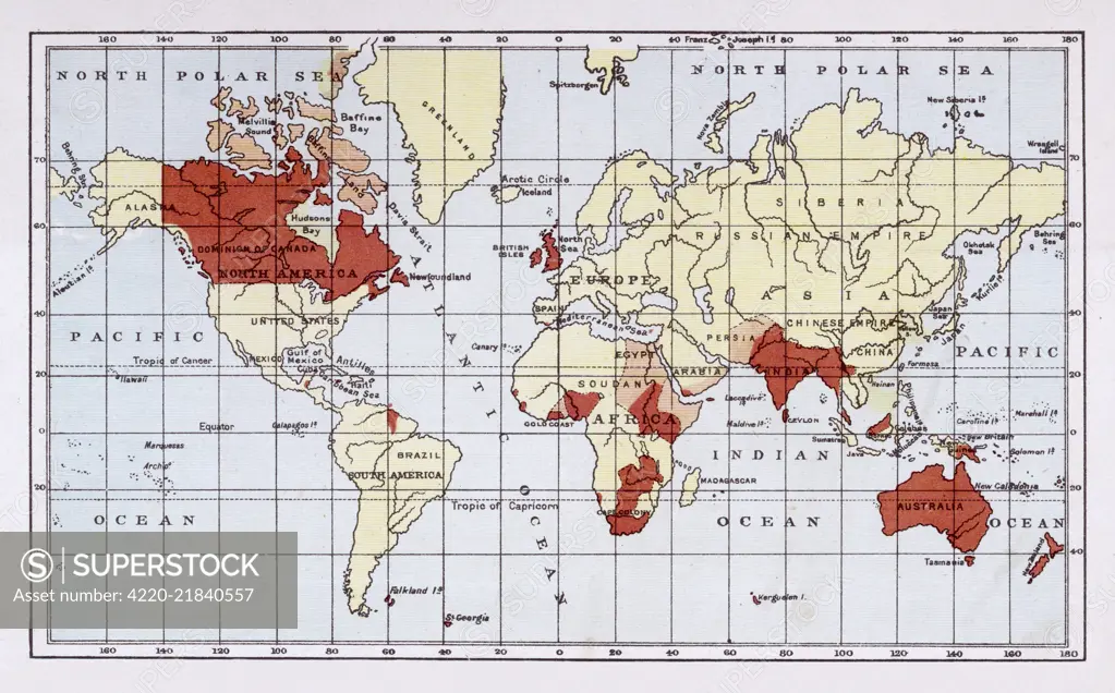
Map showing the extent of the British Empire circa 1880 Date: circa 1880
SuperStock offers millions of photos, videos, and stock assets to creatives around the world. This image of Explore the British Empire's Global Reach in the 19th Century with This Historical World Map by Mary Evans Picture Library/Pantheon is available for licensing today.
Looking for a license?
Click here, and we'll help you find it! Questions? Just ask!
Click here, and we'll help you find it! Questions? Just ask!
DETAILS
Image Number: 4220-21840557Rights ManagedCredit Line:Mary Evans Picture Library/Pantheon/SuperStockCollection:Mary Evans Picture Library Model Release:NoProperty Release:NoResolution:4759×2958