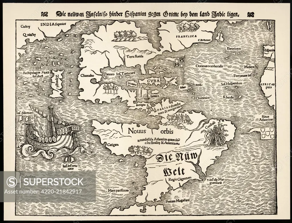
Map showing the discoveries by explorers during the first half-century after Columbus : note the confusion of India, Japan (Zipangri) and China (Cathay), & the Hesperides Date: 1540
SuperStock offers millions of photos, videos, and stock assets to creatives around the world. This image of Explore the Fascinating Details of a 16th Century Map of the Americas – A Journey Through Historical Cartography by Mary Evans Picture Library/Pantheon is available for licensing today.
Looking for a license?
Click here, and we'll help you find it! Questions? Just ask!
Click here, and we'll help you find it! Questions? Just ask!
DETAILS
Image Number: 4220-21842917Rights ManagedCredit Line:Mary Evans Picture Library/Pantheon/SuperStockCollection:Mary Evans Picture Library Model Release:NoProperty Release:NoResolution:4138×3168