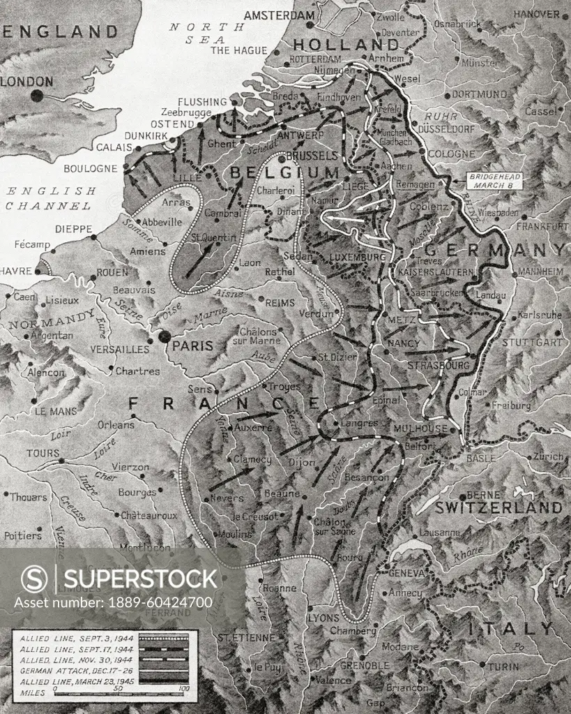
Map showing the Allied advance eastwards across France, Belgium and Holland to the Rhine from 3 September 1945 during WWII. From The War in Pictures, Sixth Year.
SuperStock offers millions of photos, videos, and stock assets to creatives around the world. This image of Map showing the Allied advance eastwards across France, Belgium and Holland to the Rhine from 3 September 1945 during WWII. From The War in Pictures, Sixth Year. by Ken Welsh/Design Pics is available for licensing today.
Looking for a license?
Click here, and we'll help you find it! Questions? Just ask!
Click here, and we'll help you find it! Questions? Just ask!
DETAILS
Image Number: 1889-60424700Rights ManagedCredit Line:Ken Welsh/Design Pics/SuperStockCollection:Design Pics Contributor:Ken Welsh Model Release:NoProperty Release:NoResolution:4067×5079