Map of the Senatorial districts of New York State, issued in 1882. The map is in color and measures 30 x 39 cm, presented on a sheet measuring 34 x 43 cm. It indicates the number of citizens, aliens, and total votes from the last general election for each district
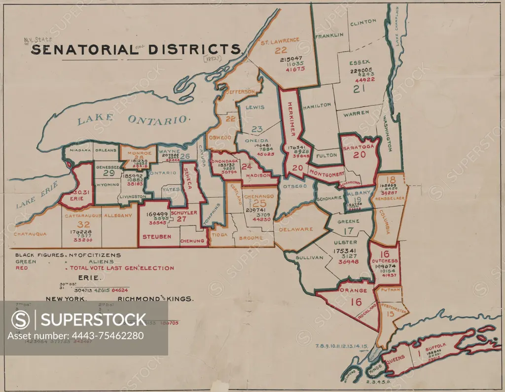
SuperStock offers millions of photos, videos, and stock assets to creatives around the world. This image of Map of the Senatorial districts of New York State, issued in 1882. The map is in color and measures 30 x 39 cm, presented on a sheet measuring 34 x 43 cm. It indicates the number of citizens, aliens, and total votes from the last general election for each district by Artokoloro is available for licensing today.
Looking for a license?
Click here, and we'll help you find it! Questions? Just ask!
Click here, and we'll help you find it! Questions? Just ask!
DETAILS
Image Number: 4443-75462280Rights ManagedCredit Line:Artokoloro/SuperStockCollection:Artokoloro Model Release:NoProperty Release:NoResolution:5700×4428