Map of Section 1, bounded by Third Avenue, Westchester Avenue, St. Ann's Avenue, E. 132nd Street, Willis Bridge, and E. 126th Street. It is part of the Final Maps and Profiles of the 23rd & 24th Wards, issued between 1892 and 1895 by the Topographical Bureau, Bronx, New York
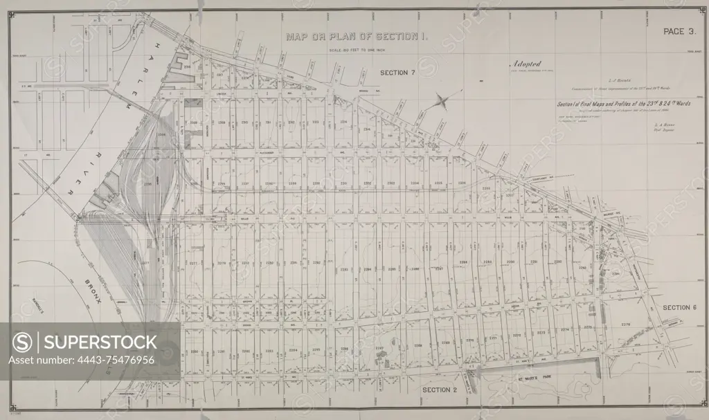
SuperStock offers millions of photos, videos, and stock assets to creatives around the world. This image of Map of Section 1, bounded by Third Avenue, Westchester Avenue, St. Ann's Avenue, E. 132nd Street, Willis Bridge, and E. 126th Street. It is part of the Final Maps and Profiles of the 23rd & 24th Wards, issued between 1892 and 1895 by the Topographical Bureau, Bronx, New York by Artokoloro is available for licensing today.
Looking for a license?
Click here, and we'll help you find it! Questions? Just ask!
Click here, and we'll help you find it! Questions? Just ask!
DETAILS
Image Number: 4443-75476956Rights ManagedCredit Line:Artokoloro/SuperStockCollection:Artokoloro Model Release:NoProperty Release:NoResolution:6578×3904