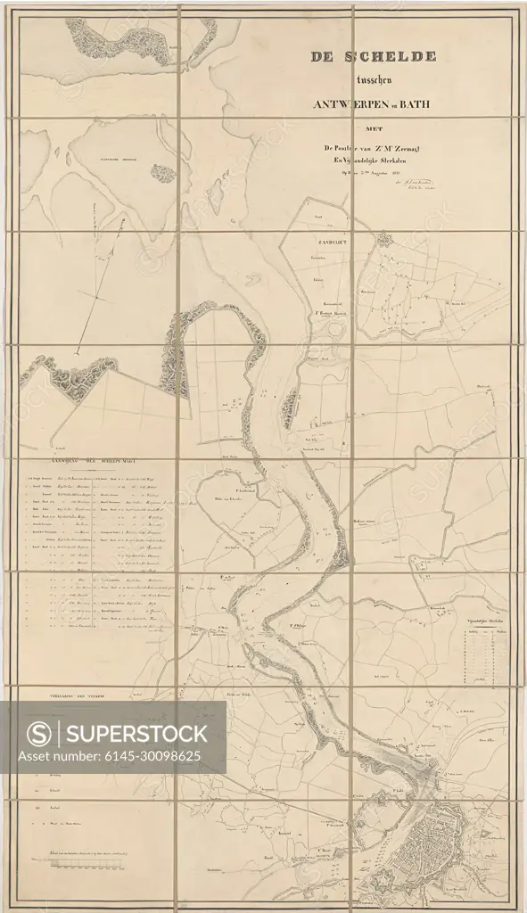
Map of the Scheldt, 1831; The Scheldt between Antwerp and Bath with the position of ZR MS sea magazines and enemy strongest. On the 3.dend AUGUST, 1831.Map of the Running Area of the River Scheldt Between Bath in Zeeland and the City of Antwerp on August 3, 1831. On The River, The Positions of the Dutch Warships Are Indicated and Numbered 1-40 (Legend On The Left). On The Right The Legend Of The Belgian Batteries Along The River Banks.
SuperStock offers millions of photos, videos, and stock assets to creatives around the world. This image of Map of the Scheldt, 1831; The Scheldt between Antwerp and Bath with the position of ZR MS sea magazines and enemy strongest. On the 3.dend AUGUST, 1831.Map of the Running Area of the River Scheldt Between Bath in Zeeland and the City of Antwerp on August 3, 1831. On The River, The Positions of the Dutch Warships Are Indicated and Numbered 1-40 (Legend On The Left). On The Right The Legend Of The Belgian Batteries Along The River Banks. by Piemags/PL Photography Limited is available for licensing today.
Looking for a license?
Click here, and we'll help you find it! Questions? Just ask!
Click here, and we'll help you find it! Questions? Just ask!
DETAILS
Image Number: 6145-30098625Royalty FreeCredit Line:Piemags/PL Photography Limited/SuperStockCollection:PL Photography Limited Contributor:Piemags Model Release:NoProperty Release:NoResolution:1444×2500