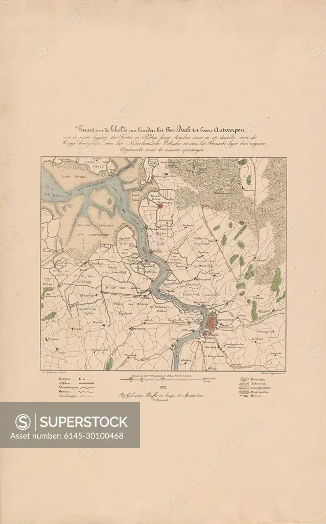
Map of the Scheldt, 1832; Map of the Scheldt from below the Fort Bath to the top Antwerp, with the right location of the forts and polders along Derzelver bank and on which they can check the Martial Movements of the Dutch Squadron and the French Army. Folder of the Course of the Scheldt from Fort Bath to Antwerp. In Connection With The Siege Of The Citadel or Antwerp by the French Army, December 1832. At the Bottom of a Scale and Legend Of The Symbols Used.
SuperStock offers millions of photos, videos, and stock assets to creatives around the world. This image of Map of the Scheldt, 1832; Map of the Scheldt from below the Fort Bath to the top Antwerp, with the right location of the forts and polders along Derzelver bank and on which they can check the Martial Movements of the Dutch Squadron and the French Army. Folder of the Course of the Scheldt from Fort Bath to Antwerp. In Connection With The Siege Of The Citadel or Antwerp by the French Army, December 1832. At the Bottom of a Scale and Legend Of The Symbols Used. by Piemags/PL Photography Limited is available for licensing today.
Looking for a license?
Click here, and we'll help you find it! Questions? Just ask!
Click here, and we'll help you find it! Questions? Just ask!
DETAILS
Image Number: 6145-30100468Royalty FreeCredit Line:Piemags/PL Photography Limited/SuperStockCollection:PL Photography Limited Contributor:Piemags Model Release:NoProperty Release:NoResolution:1560×2500