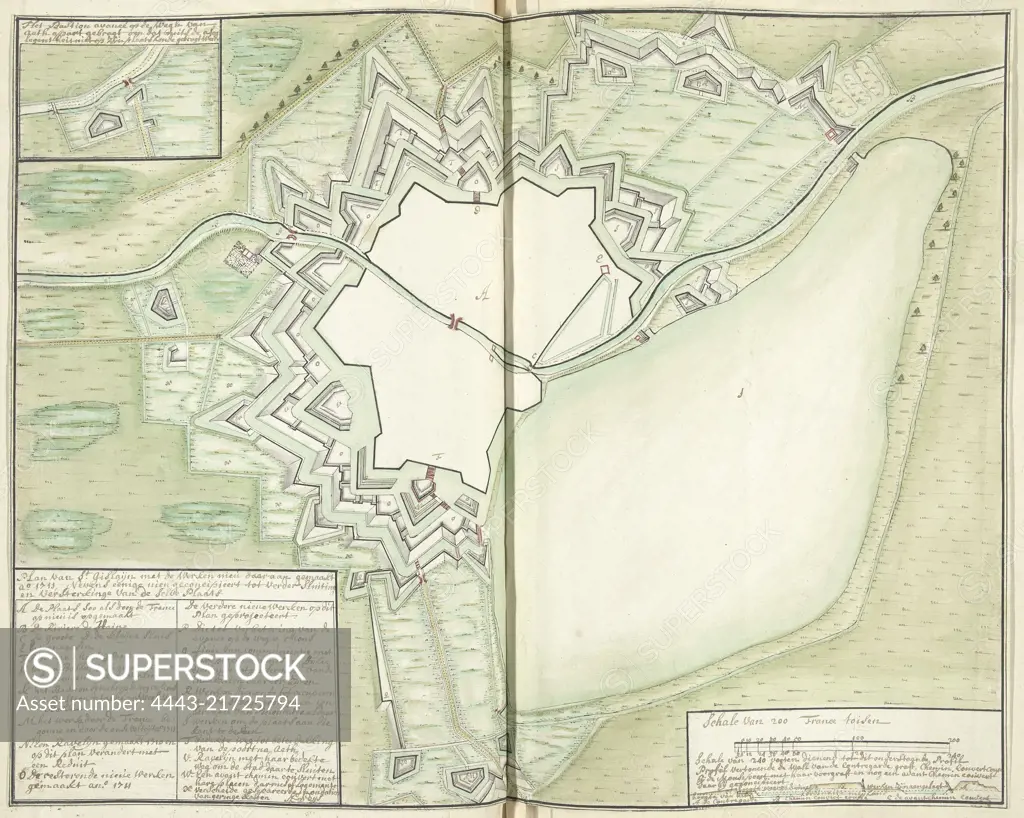
Map of Saint-Ghislain, 1711, A. Seys, 1711, Map of the town of Saint-Ghislain with the new fortifications constructed in 1711. Bottom left the title and legend A-X in Dutch. Bottom right the scale indication and a cross section of the ramparts. The drawing is accompanied by a separate folded sheet with an explanation by the engineer Seys of why the plans for the new ramparts were drawn up. Part of a collection of drawn plans of fortified places in the Netherlands and surrounding countries at the time of the War of the Spanish Succession (part C)., draughtsman: A. Seys, (mentioned on object), A. Seys, (mentioned on object), Netherlands, 1711, paper, h 368 mm × w 465 mm
SuperStock offers millions of photos, videos, and stock assets to creatives around the world. This image of Map of Saint-Ghislain, 1711, A. Seys, 1711, Map of the town of Saint-Ghislain with the new fortifications constructed in 1711. Bottom left the title and legend A-X in Dutch. Bottom right the scale indication and a cross section of the ramparts. The drawing is accompanied by a separate folded sheet with an explanation by the engineer Seys of why the plans for the new ramparts were drawn up. Part of a collection of drawn plans of fortified places in the Netherlands and surrounding countries at the time of the War of the Spanish Succession (part C)., draughtsman: A. Seys, (mentioned on object), A. Seys, (mentioned on object), Netherlands, 1711, paper, h 368 mm × w 465 mm by Artokoloro is available for licensing today.
Looking for a license?
Click here, and we'll help you find it! Questions? Just ask!
Click here, and we'll help you find it! Questions? Just ask!
DETAILS
Image Number: 4443-21725794Rights ManagedCredit Line:Artokoloro/SuperStockCollection:Artokoloro Model Release:NoProperty Release:NoResolution:5402×4320