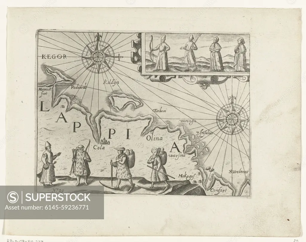
Map of the Russian coast with the town of Kola, 1597, 1615 - 1617 print Map of the Russian coast with the town of Kola near Murmansk, where the boats arrived on August 25, 1597. Below and above four examples of the costume of the local residents. Copies to the original illustrations in the travelogue of the journey of Willem Barendsz and Jacob van Heemskerck in 1596-1597 and the stay on the island of Nova Zembla, No. 29. Northern Netherlands paper engraving exploration, expedition, voyage of discovery. landscapes in polar regions. maps of separate countries or regions Nova Zembla. Murmansk. Kola
SuperStock offers millions of photos, videos, and stock assets to creatives around the world. This image of Map of the Russian coast with the town of Kola, 1597, 1615 - 1617 print Map of the Russian coast with the town of Kola near Murmansk, where the boats arrived on August 25, 1597. Below and above four examples of the costume of the local residents. Copies to the original illustrations in the travelogue of the journey of Willem Barendsz and Jacob van Heemskerck in 1596-1597 and the stay on the island of Nova Zembla, No. 29. Northern Netherlands paper engraving exploration, expedition, voyage of discovery. landscapes in polar regions. maps of separate countries or regions Nova Zembla. Murmansk. Kola by Piemags/PL Photography Limited is available for licensing today.
DETAILS
Image Number: 6145-59236771Royalty FreeCredit Line:Piemags/PL Photography Limited/SuperStockCollection:PL Photography Limited Contributor:Piemags Model Release:NoProperty Release:NoResolution:6132×4862