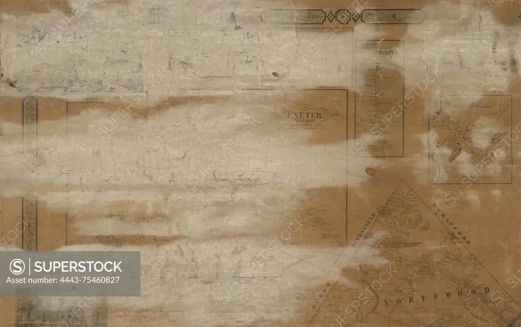
Map of Rockingham Co., New Hampshire, 1857, Smith & Coffin. Additional, Map of Rockingham County, New Hampshire., 1857., 17 & 19 Minor St., Philadelphia. Publisher, Smith & Coffin. Landowners, Rockingham County, New Hampshire. Administrative and political divisions, New Hampshire., 1 map, hand-colored; 121 x 138 cm, on sheet 145 x 149 cm. Divided into 6 sheets, 49 x 76 cm or smaller. NYPL Map Div. copy imperfect several faded spots along the left side., A hand-colored map of Rockingham County, New Hampshire, from 1857. The map is divided into six smaller sheets, and it features property lines and landowner names. The overall dimensions are 121 x 138 cm, printed on a larger sheet measuring 145 x 149 cm. The map shows administrative and political divisions within the county and includes imperfections such as faded spots along the left side
SuperStock offers millions of photos, videos, and stock assets to creatives around the world. This image of Map of Rockingham Co., New Hampshire, 1857, Smith & Coffin. Additional, Map of Rockingham County, New Hampshire., 1857., 17 & 19 Minor St., Philadelphia. Publisher, Smith & Coffin. Landowners, Rockingham County, New Hampshire. Administrative and political divisions, New Hampshire., 1 map, hand-colored; 121 x 138 cm, on sheet 145 x 149 cm. Divided into 6 sheets, 49 x 76 cm or smaller. NYPL Map Div. copy imperfect several faded spots along the left side., A hand-colored map of Rockingham County, New Hampshire, from 1857. The map is divided into six smaller sheets, and it features property lines and landowner names. The overall dimensions are 121 x 138 cm, printed on a larger sheet measuring 145 x 149 cm. The map shows administrative and political divisions within the county and includes imperfections such as faded spots along the left side by Artokoloro is available for licensing today.
Looking for a license?
Click here, and we'll help you find it! Questions? Just ask!
Click here, and we'll help you find it! Questions? Just ask!
DETAILS
Image Number: 4443-75460827Rights ManagedCredit Line:Artokoloro/SuperStockCollection:Artokoloro Model Release:NoProperty Release:NoResolution:5700×3576