Map of a reconnaissance of the Black Hills conducted in July and August 1874, featuring troops under the command of Lt. Col. G.A. Custer, 7th Cavalry. The map was issued in 1874 by the Corps of Engineers in Washington, D.C. It is a military map depicting the Black Hills region of South Dakota and Wyoming, measuring 62 x 54 cm
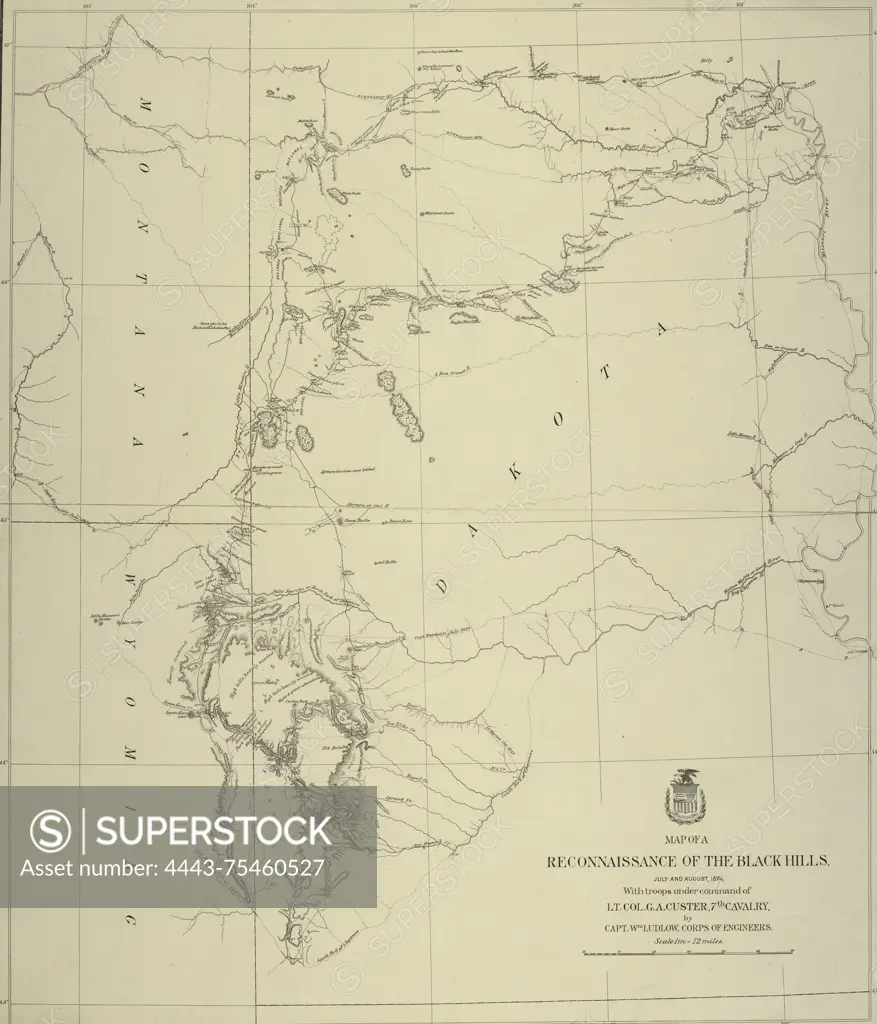
SuperStock offers millions of photos, videos, and stock assets to creatives around the world. This image of Map of a reconnaissance of the Black Hills conducted in July and August 1874, featuring troops under the command of Lt. Col. G.A. Custer, 7th Cavalry. The map was issued in 1874 by the Corps of Engineers in Washington, D.C. It is a military map depicting the Black Hills region of South Dakota and Wyoming, measuring 62 x 54 cm by Artokoloro is available for licensing today.
Looking for a license?
Click here, and we'll help you find it! Questions? Just ask!
Click here, and we'll help you find it! Questions? Just ask!
DETAILS
Image Number: 4443-75460527Rights ManagedCredit Line:Artokoloro/SuperStockCollection:Artokoloro Model Release:NoProperty Release:NoResolution:4590×5358