Map of the railroads of the state of New York, 1856. Issued by the New York State Board of Railroad Commissioners., 1856., Albany, N.Y., 1 map; hand colored; 57 x 74 cm, on sheet 60 x 76 cm. The map includes railroads in New York State as well as neighboring states such as Pennsylvania, New Jersey, Vermont, Massachusetts, and Connecticut, along with canals and administrative and political divisions of New York
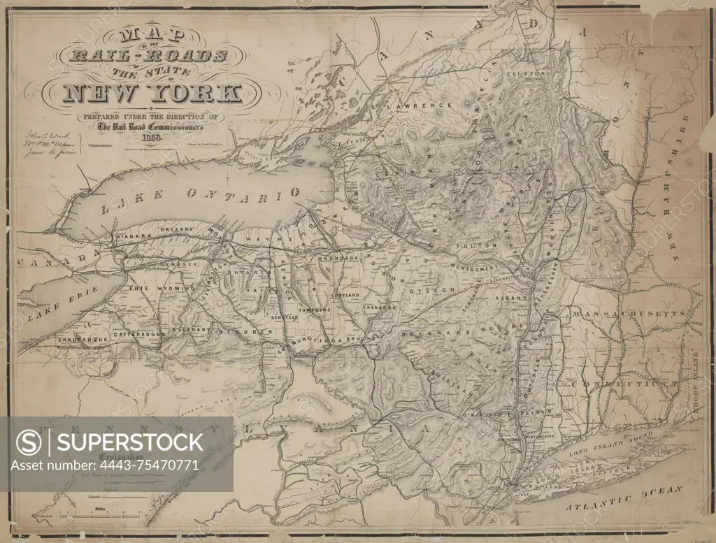
SuperStock offers millions of photos, videos, and stock assets to creatives around the world. This image of Map of the railroads of the state of New York, 1856. Issued by the New York State Board of Railroad Commissioners., 1856., Albany, N.Y., 1 map; hand colored; 57 x 74 cm, on sheet 60 x 76 cm. The map includes railroads in New York State as well as neighboring states such as Pennsylvania, New Jersey, Vermont, Massachusetts, and Connecticut, along with canals and administrative and political divisions of New York by Artokoloro is available for licensing today.
Looking for a license?
Click here, and we'll help you find it! Questions? Just ask!
Click here, and we'll help you find it! Questions? Just ask!
DETAILS
Image Number: 4443-75470771Rights ManagedCredit Line:Artokoloro/SuperStockCollection:Artokoloro Model Release:NoProperty Release:NoResolution:5700×4328