Map of the railroads of Massachusetts, published in 1887 by the Board of Railroad Commissioners. The map is in color and measures 69 x 86 cm on a sheet of 72 x 91 cm. It was printed by the Press of Wright & Potter Printing Company in Boston, Massachusetts
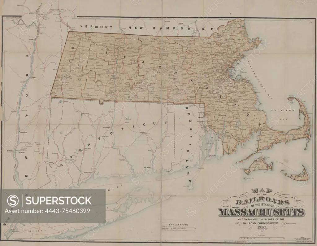
SuperStock offers millions of photos, videos, and stock assets to creatives around the world. This image of Map of the railroads of Massachusetts, published in 1887 by the Board of Railroad Commissioners. The map is in color and measures 69 x 86 cm on a sheet of 72 x 91 cm. It was printed by the Press of Wright & Potter Printing Company in Boston, Massachusetts by Artokoloro is available for licensing today.
Looking for a license?
Click here, and we'll help you find it! Questions? Just ask!
Click here, and we'll help you find it! Questions? Just ask!
DETAILS
Image Number: 4443-75460399Rights ManagedCredit Line:Artokoloro/SuperStockCollection:Artokoloro Model Release:NoProperty Release:NoResolution:5700×4423