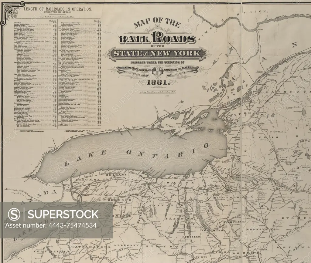
Map of the rail roads of the State of New York, 1881. Additional, Map of the railroads of the State of New York., 1881., Albany, N.Y. Railroads and canals in New York (State), along with administrative and political divisions., 1 map; dimensions 86 x 110 cm, on sheet 91 x 115 cm
SuperStock offers millions of photos, videos, and stock assets to creatives around the world. This image of Map of the rail roads of the State of New York, 1881. Additional, Map of the railroads of the State of New York., 1881., Albany, N.Y. Railroads and canals in New York (State), along with administrative and political divisions., 1 map; dimensions 86 x 110 cm, on sheet 91 x 115 cm by Artokoloro is available for licensing today.
Looking for a license?
Click here, and we'll help you find it! Questions? Just ask!
Click here, and we'll help you find it! Questions? Just ask!
DETAILS
Image Number: 4443-75474534Rights ManagedCredit Line:Artokoloro/SuperStockCollection:Artokoloro Model Release:NoProperty Release:NoResolution:5700×4830