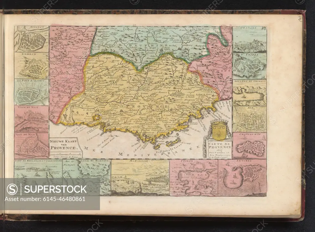
Map of Provence; New map of Provence / Carte de Provence. Provence map in France, to the map fifteen smaller floor plans and faces on cities. Part of an Atlas with 223 maps of countries and cities and war scaffolding in Europe in the period approx. 1690-1735.
SuperStock offers millions of photos, videos, and stock assets to creatives around the world. This image of Map of Provence; New map of Provence / Carte de Provence. Provence map in France, to the map fifteen smaller floor plans and faces on cities. Part of an Atlas with 223 maps of countries and cities and war scaffolding in Europe in the period approx. 1690-1735. by Piemags/PL Photography Limited is available for licensing today.
Looking for a license?
Click here, and we'll help you find it! Questions? Just ask!
Click here, and we'll help you find it! Questions? Just ask!
DETAILS
Image Number: 6145-46480861Royalty FreeCredit Line:Piemags/PL Photography Limited/SuperStockCollection:PL Photography Limited Contributor:Piemags Model Release:NoProperty Release:NoResolution:2500×1846