Map of property at New Brighton, Staten Island, belonging to J. Brown Esq., issued between 1800 and 1899. The map, measuring 109 x 69 cm, is hand colored and includes details on homes and real property in the New Brighton area of New York, specifically in Richmond County. It may have been published in Brooklyn, N.Y., by an unknown publisher
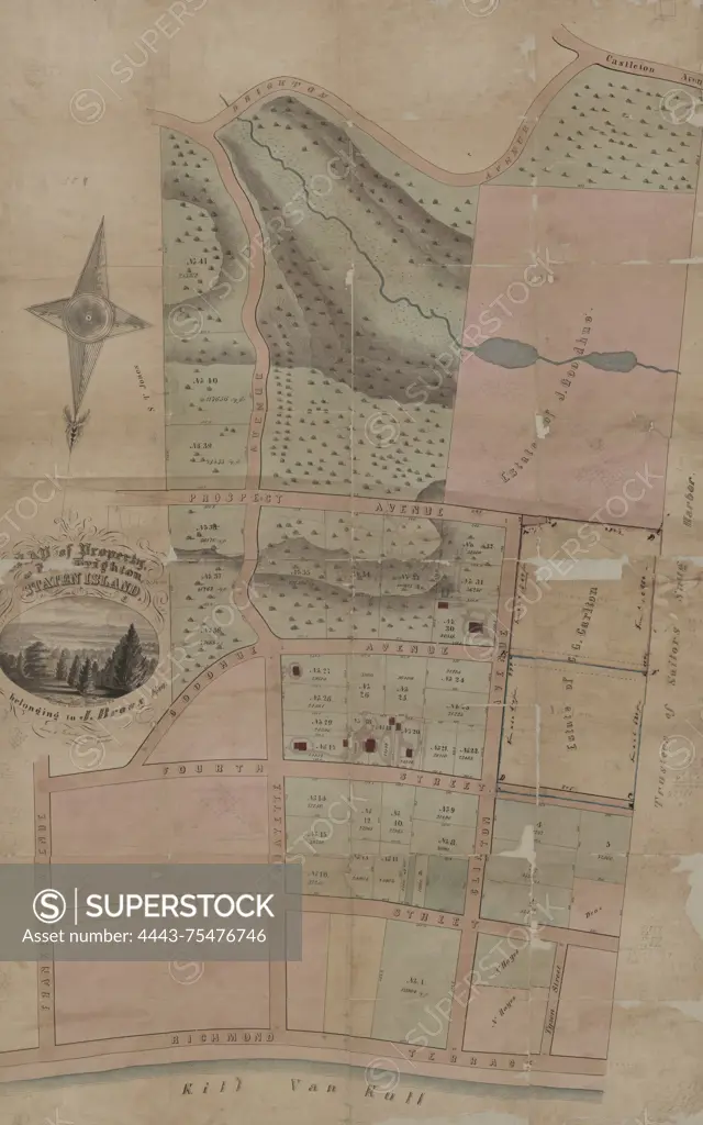
SuperStock offers millions of photos, videos, and stock assets to creatives around the world. This image of Map of property at New Brighton, Staten Island, belonging to J. Brown Esq., issued between 1800 and 1899. The map, measuring 109 x 69 cm, is hand colored and includes details on homes and real property in the New Brighton area of New York, specifically in Richmond County. It may have been published in Brooklyn, N.Y., by an unknown publisher by Artokoloro is available for licensing today.
Looking for a license?
Click here, and we'll help you find it! Questions? Just ask!
Click here, and we'll help you find it! Questions? Just ask!
DETAILS
Image Number: 4443-75476746Rights ManagedCredit Line:Artokoloro/SuperStockCollection:Artokoloro Model Release:NoProperty Release:NoResolution:3564×5700