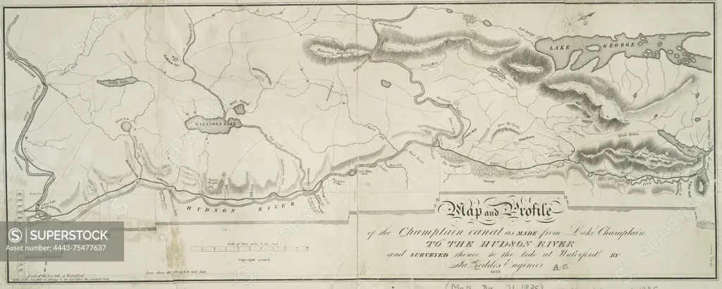
Map and profile of the Champlain Canal from Lake Champlain to the Hudson River, surveyed to the tide at Waterford, issued in 1825., 1825, Albany, N.Y., Publisher, Jas. Geddes, New York (N.Y.), New Jersey. Topics include Champlain Canal (N.Y.) altitudes, maps, and the Hudson River Valley (N.Y. and N.J.)., 1 map and 1 profile; 20 x 50 cm
SuperStock offers millions of photos, videos, and stock assets to creatives around the world. This image of Map and profile of the Champlain Canal from Lake Champlain to the Hudson River, surveyed to the tide at Waterford, issued in 1825., 1825, Albany, N.Y., Publisher, Jas. Geddes, New York (N.Y.), New Jersey. Topics include Champlain Canal (N.Y.) altitudes, maps, and the Hudson River Valley (N.Y. and N.J.)., 1 map and 1 profile; 20 x 50 cm by Artokoloro is available for licensing today.
Looking for a license?
Click here, and we'll help you find it! Questions? Just ask!
Click here, and we'll help you find it! Questions? Just ask!
DETAILS
Image Number: 4443-75477637Rights ManagedCredit Line:Artokoloro/SuperStockCollection:Artokoloro Model Release:NoProperty Release:NoResolution:5145×2063