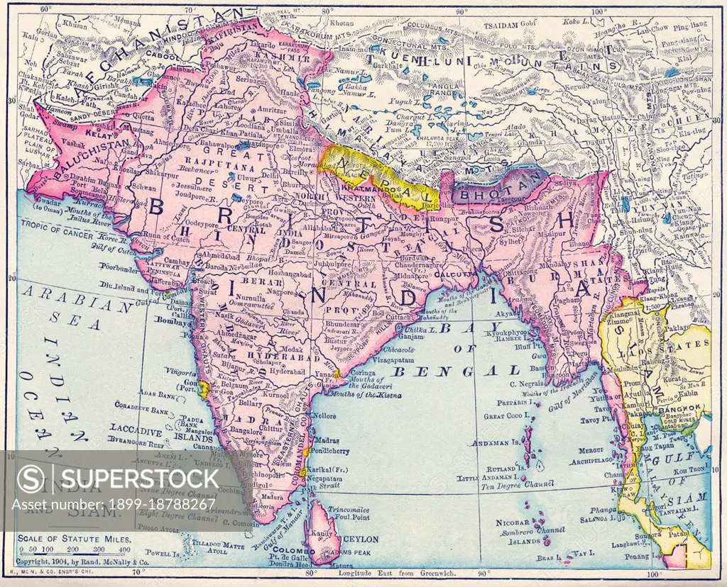
This map was produced at the height of British Imperial power and shows direct British rule extending all the way from Iran (Persia) to Thailand (Siam). Most of the contiguous Indian Ocean littoral, from South Africa to Singapore and Australia, was also under British administration or de facto control. It is relevant to note that the map shows Sikkim extending north into the present-day territory of China's Tibetan Autonomous Region. Similarly Darjeeling is shown in eastern Nepal, while Bhutan is elongated to the east and most of India's Arunachal Pradesh province is shown as part of the Qing Empire. In Kashmir, by contrast, the disputed Aksai Chin region, now under Chinese control, is shown as part of India.
SuperStock offers millions of photos, videos, and stock assets to creatives around the world. This image of This map was produced at the height of British Imperial power and shows direct British rule extending all the way from Iran (Persia) to Thailand (Siam). Most of the contiguous Indian Ocean littoral, from South Africa to Singapore and Australia, was also under British administration or de facto control. It is relevant to note that the map shows Sikkim extending north into the present-day territory of China's Tibetan Autonomous Region. Similarly Darjeeling is shown in eastern Nepal, while Bhutan is elongated to the east and most of India's Arunachal Pradesh province is shown as part of the Qing Empire. In Kashmir, by contrast, the disputed Aksai Chin region, now under Chinese control, is shown as part of India. by Pictures From History/Universal Images is available for licensing today.
Looking for a license?
Click here, and we'll help you find it! Questions? Just ask!
Click here, and we'll help you find it! Questions? Just ask!
DETAILS
Image Number: 1899-18788267Rights ManagedCredit Line:Pictures From History/Universal Images/SuperStockCollection: