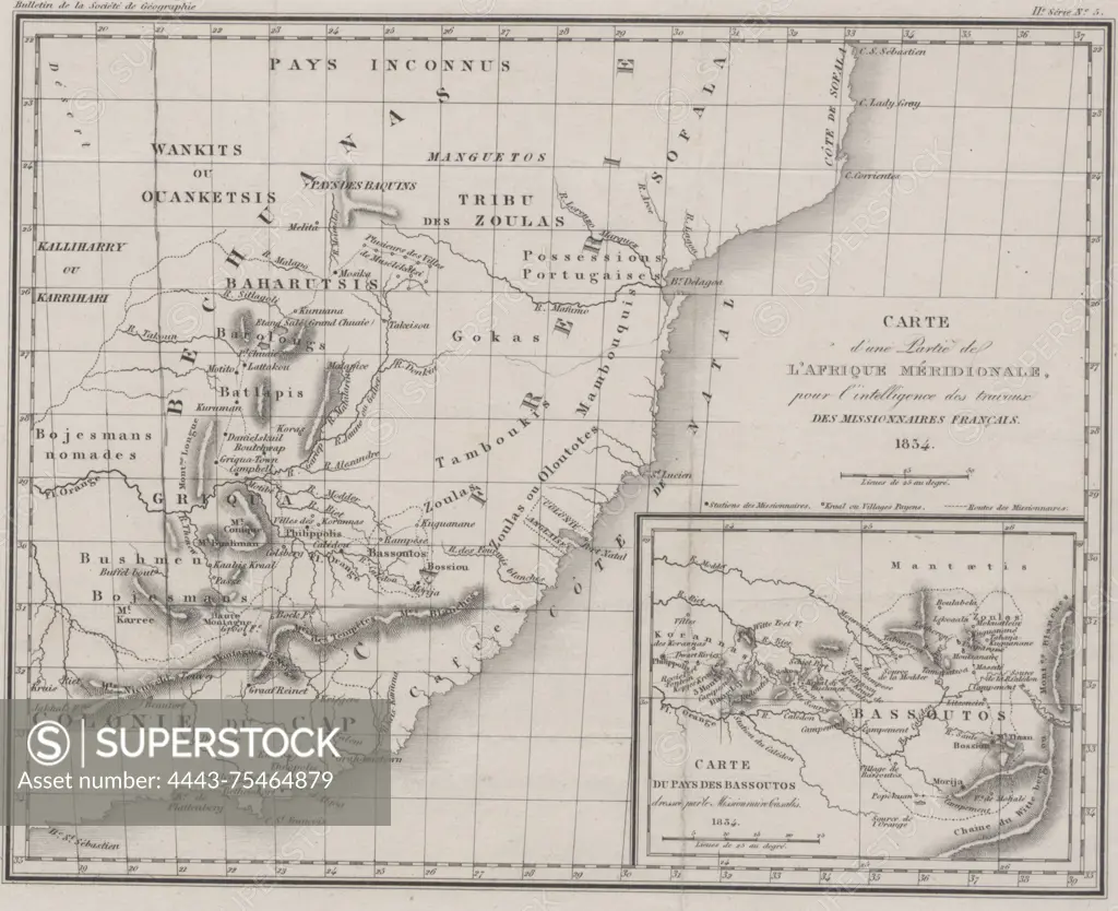
Map of a portion of Southern Africa, intended to aid in understanding the work of French missionaries. Issued in 1834 by the Société de géographie in Paris. The map measures 19 x 24 cm and is colored
SuperStock offers millions of photos, videos, and stock assets to creatives around the world. This image of Map of a portion of Southern Africa, intended to aid in understanding the work of French missionaries. Issued in 1834 by the Société de géographie in Paris. The map measures 19 x 24 cm and is colored by Artokoloro is available for licensing today.
Looking for a license?
Click here, and we'll help you find it! Questions? Just ask!
Click here, and we'll help you find it! Questions? Just ask!
DETAILS
Image Number: 4443-75464879Rights ManagedCredit Line:Artokoloro/SuperStockCollection:Artokoloro Model Release:NoProperty Release:NoResolution:3034×2472