Map of a portion of Flushing, located in Queens County, New York, published in 1873 by Beers, Comstock & Cline. The map features various streets, including Boerum Avenue, Brewster Avenue, Parsons Avenue, Sanford Avenue, Jamaica Avenue, Ireland Avenue, Whittier Avenue, Tennyson Avenue, and Longfellow Avenue. It provides a geographical overview of the area during that period
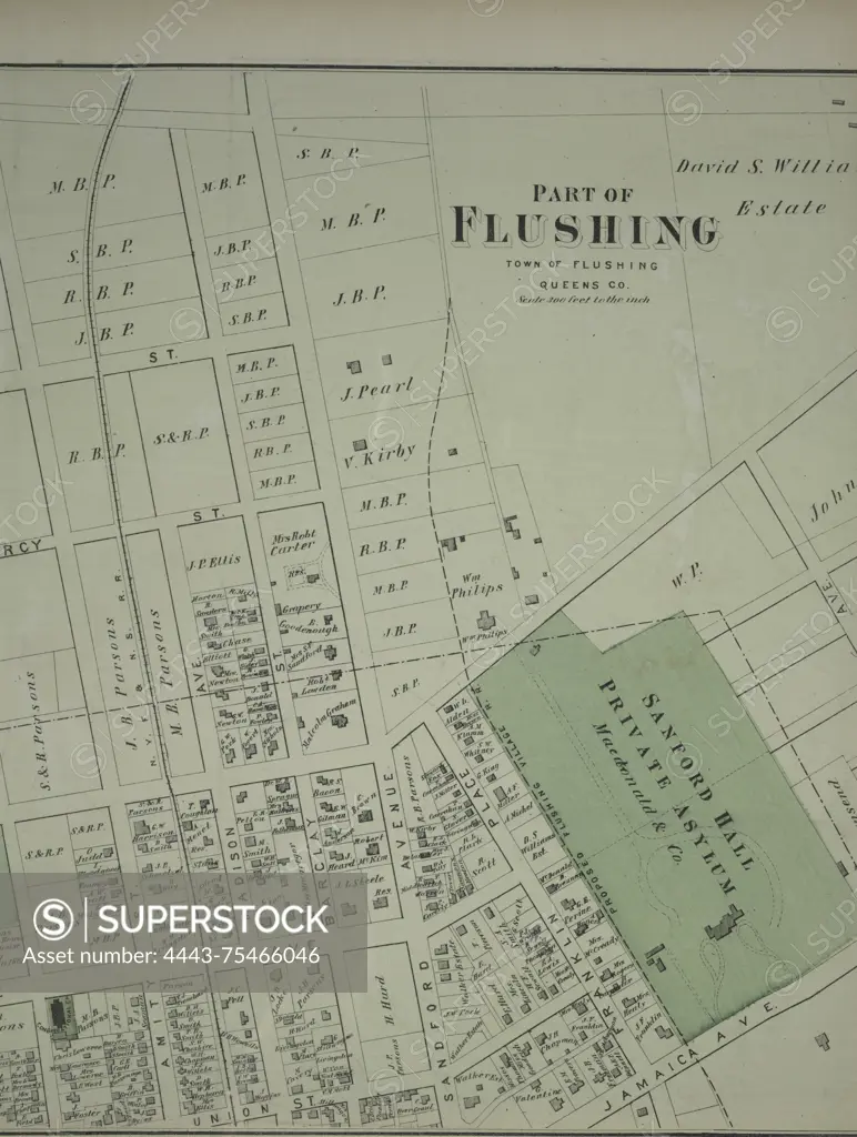
SuperStock offers millions of photos, videos, and stock assets to creatives around the world. This image of Map of a portion of Flushing, located in Queens County, New York, published in 1873 by Beers, Comstock & Cline. The map features various streets, including Boerum Avenue, Brewster Avenue, Parsons Avenue, Sanford Avenue, Jamaica Avenue, Ireland Avenue, Whittier Avenue, Tennyson Avenue, and Longfellow Avenue. It provides a geographical overview of the area during that period by Artokoloro is available for licensing today.
Looking for a license?
Click here, and we'll help you find it! Questions? Just ask!
Click here, and we'll help you find it! Questions? Just ask!
DETAILS
Image Number: 4443-75466046Rights ManagedCredit Line:Artokoloro/SuperStockCollection:Artokoloro Model Release:NoProperty Release:NoResolution:4347×5763