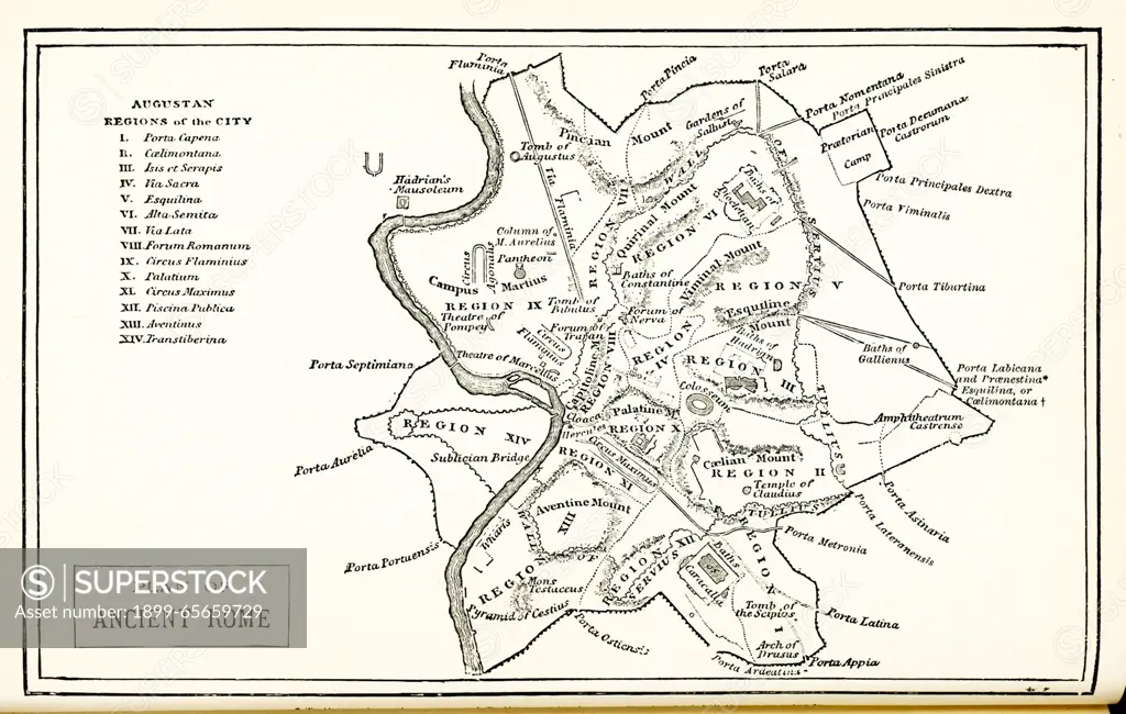
Map with Plan of Ancient Rome. This plan from 1876 shows: Augustan Regions of City: I. Porta Capena, II. Caelimontana, III. Isis et Serapis, IV. Via Sacra, V. Esquilina, VI. Alta Semita, VII. Via Lata, VIII. Forum Romanum, IX. Circus Flaminius, X. Palatium, XI. Circus Maximus, XII. Piscina Publica, XIII. Aventinus, XIV. Transtiberina.
SuperStock offers millions of photos, videos, and stock assets to creatives around the world. This image of Map with Plan of Ancient Rome. This plan from 1876 shows: Augustan Regions of City: I. Porta Capena, II. Caelimontana, III. Isis et Serapis, IV. Via Sacra, V. Esquilina, VI. Alta Semita, VII. Via Lata, VIII. Forum Romanum, IX. Circus Flaminius, X. Palatium, XI. Circus Maximus, XII. Piscina Publica, XIII. Aventinus, XIV. Transtiberina. by Ivy Close Images/Universal Images is available for licensing today.
Looking for a license?
Click here, and we'll help you find it! Questions? Just ask!
Click here, and we'll help you find it! Questions? Just ask!
DETAILS
Image Number: 1899-65659729Rights ManagedCredit Line:Ivy Close Images/Universal Images/SuperStockCollection:Universal Images Contributor:Ivy Close Images Model Release:NoProperty Release:NoResolution:5400×3428