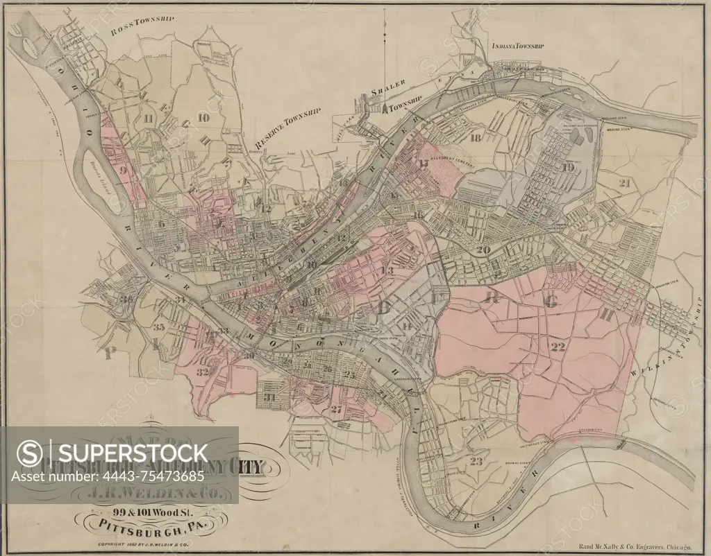
Map of Pittsburgh and Allegheny City, 1882, J.R. Weldin & Co., 1882., Pittsburgh, Pa. Publisher, J.R. Weldin & Co., Pittsburgh (Pa.)., 1 map hand colored; 53 x 67 cm, folded into cover 15 x 8 cm. Note NYPL Map Div. copy lacks cover; filed flat
SuperStock offers millions of photos, videos, and stock assets to creatives around the world. This image of Map of Pittsburgh and Allegheny City, 1882, J.R. Weldin & Co., 1882., Pittsburgh, Pa. Publisher, J.R. Weldin & Co., Pittsburgh (Pa.)., 1 map hand colored; 53 x 67 cm, folded into cover 15 x 8 cm. Note NYPL Map Div. copy lacks cover; filed flat by Artokoloro is available for licensing today.
Looking for a license?
Click here, and we'll help you find it! Questions? Just ask!
Click here, and we'll help you find it! Questions? Just ask!
DETAILS
Image Number: 4443-75473685Rights ManagedCredit Line:Artokoloro/SuperStockCollection:Artokoloro Model Release:NoProperty Release:NoResolution:5700×4467