Map of Pettis County, Missouri, published in 1876 by Warner & Foote. The map is hand-colored and consists of 4 sheets. Its overall dimensions are 152 x 132 cm, with individual sheets measuring 79 x 67 cm or smaller. It details real property and landowners in Pettis County, located in Missouri. The map was issued in Sedalia, Missouri, and published in Philadelphia
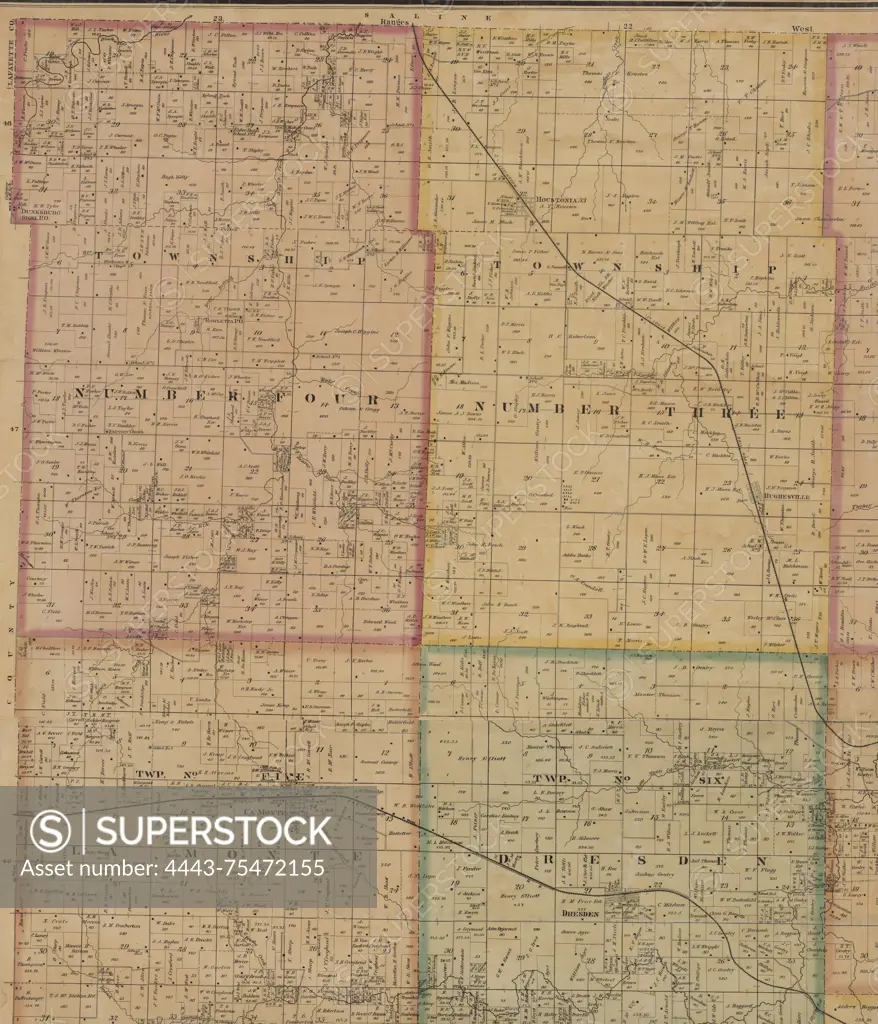
SuperStock offers millions of photos, videos, and stock assets to creatives around the world. This image of Map of Pettis County, Missouri, published in 1876 by Warner & Foote. The map is hand-colored and consists of 4 sheets. Its overall dimensions are 152 x 132 cm, with individual sheets measuring 79 x 67 cm or smaller. It details real property and landowners in Pettis County, located in Missouri. The map was issued in Sedalia, Missouri, and published in Philadelphia by Artokoloro is available for licensing today.
Looking for a license?
Click here, and we'll help you find it! Questions? Just ask!
Click here, and we'll help you find it! Questions? Just ask!
DETAILS
Image Number: 4443-75472155Rights ManagedCredit Line:Artokoloro/SuperStockCollection:Artokoloro Model Release:NoProperty Release:NoResolution:4892×5700