A map of Pennsylvania, issued in 1795, printed by F. and R. Bailey in Philadelphia. The map measures 15 x 18 cm and represents early works related to Pennsylvania's roads and geography prior to 1800
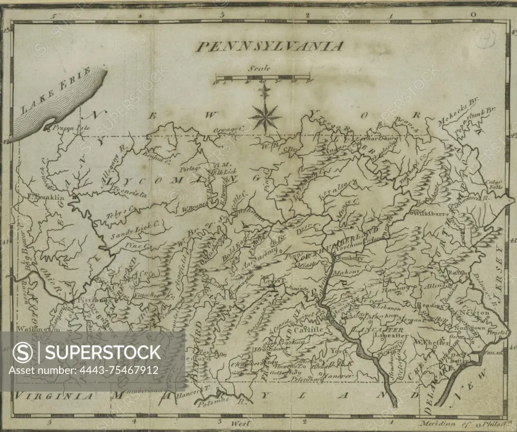
SuperStock offers millions of photos, videos, and stock assets to creatives around the world. This image of A map of Pennsylvania, issued in 1795, printed by F. and R. Bailey in Philadelphia. The map measures 15 x 18 cm and represents early works related to Pennsylvania's roads and geography prior to 1800 by Artokoloro is available for licensing today.
Looking for a license?
Click here, and we'll help you find it! Questions? Just ask!
Click here, and we'll help you find it! Questions? Just ask!
DETAILS
Image Number: 4443-75467912Rights ManagedCredit Line:Artokoloro/SuperStockCollection:Artokoloro Model Release:NoProperty Release:NoResolution:4104×3429