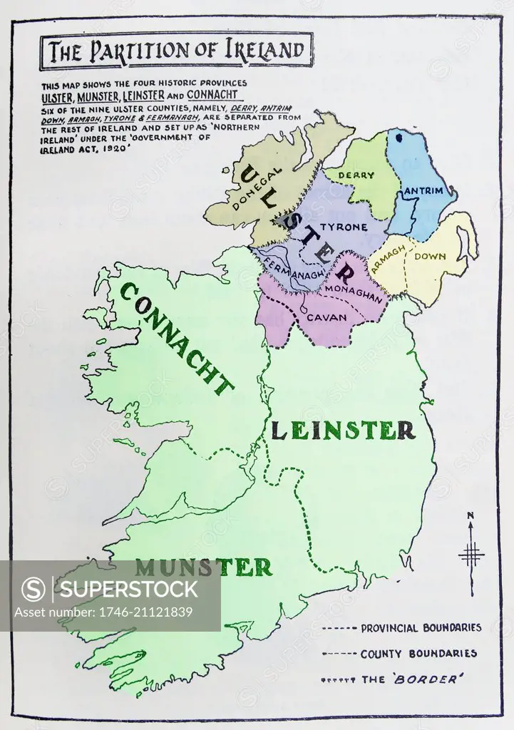
Map of the partition of Ireland; the division of the island of Ireland into two distinct territories; Northern Ireland and Southern Ireland in 1921
SuperStock offers millions of photos, videos, and stock assets to creatives around the world. This image of Map of the partition of Ireland; the division of the island of Ireland into two distinct territories; Northern Ireland and Southern Ireland in 1921 by Image Asset Management/World History Archive is available for licensing today.
DETAILS
Image Number: 1746-21121839Rights ManagedCredit Line:Image Asset Management/World History Archive/SuperStockCollection: