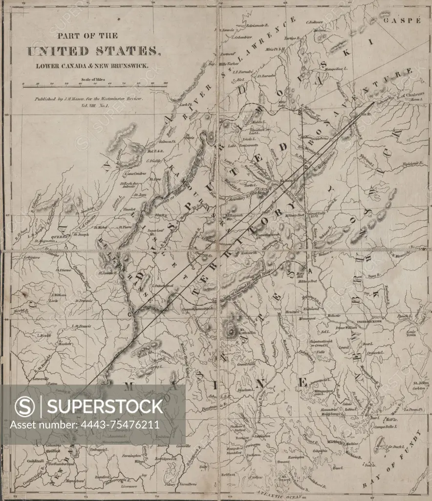
Map of part of the United States, Lower Canada, and New Brunswick, issued in 1840 by J.M. Mason in New York, N.Y. The map depicts boundary disputes, specifically the northeast boundary of the United States, including territories of Maine, New Brunswick, and Québec. The extent of the map is 33 x 28 cm
SuperStock offers millions of photos, videos, and stock assets to creatives around the world. This image of Map of part of the United States, Lower Canada, and New Brunswick, issued in 1840 by J.M. Mason in New York, N.Y. The map depicts boundary disputes, specifically the northeast boundary of the United States, including territories of Maine, New Brunswick, and Québec. The extent of the map is 33 x 28 cm by Artokoloro is available for licensing today.
Looking for a license?
Click here, and we'll help you find it! Questions? Just ask!
Click here, and we'll help you find it! Questions? Just ask!
DETAILS
Image Number: 4443-75476211Rights ManagedCredit Line:Artokoloro/SuperStockCollection:Artokoloro Model Release:NoProperty Release:NoResolution:4925×5700