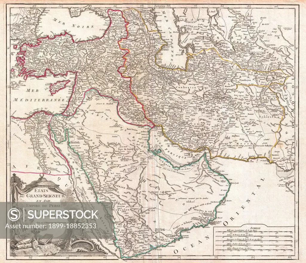
In this 1753 map of the Ottoman Empire. Vaugondy maps the empire at its height, with territory spanning from the Black Sea to the southernmost extension of Arabia and west, inclusive of Persia, as far as the Mongol Empire of India. This includes the modern day nations of Turkey, Egypt, Saudi Arabia, Oman, Yemen, the United Arab Emirates, Iran, Iraq, Kuwait, Israel, Palestine, Jordan, Syria, Lebanon, Armenia, Azerbaijan, Georgia, and parts of Afghanistan, Pakistan, India, Uzbekistan, and Greece. Vaugondy employs all of the latest geographical information of the time incorporating both French and transliterations Arabic place names. Drawn by Robert de Vaugondy in 1753 and published in the 1757 issue of his Atlas Universal.
SuperStock offers millions of photos, videos, and stock assets to creatives around the world. This image of In this 1753 map of the Ottoman Empire. Vaugondy maps the empire at its height, with territory spanning from the Black Sea to the southernmost extension of Arabia and west, inclusive of Persia, as far as the Mongol Empire of India. This includes the modern day nations of Turkey, Egypt, Saudi Arabia, Oman, Yemen, the United Arab Emirates, Iran, Iraq, Kuwait, Israel, Palestine, Jordan, Syria, Lebanon, Armenia, Azerbaijan, Georgia, and parts of Afghanistan, Pakistan, India, Uzbekistan, and Greece. Vaugondy employs all of the latest geographical information of the time incorporating both French and transliterations Arabic place names. Drawn by Robert de Vaugondy in 1753 and published in the 1757 issue of his Atlas Universal. by Pictures from History/Universal Images is available for licensing today.
Looking for a license?
Click here, and we'll help you find it! Questions? Just ask!
Click here, and we'll help you find it! Questions? Just ask!
DETAILS
Image Number: 1899-18852353Rights ManagedCredit Line:Pictures from History/Universal Images/SuperStockCollection:
