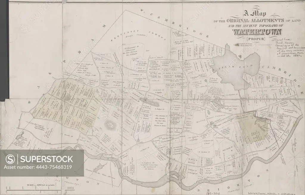
A map of the original allotments of land and the ancient topography of Watertown proper, 1860, New England Historic Genealogical Society., 1860., Boston, Mass. Publisher, N.E. Historic-Genealogical Society. Real property, Massachusetts, Watertown; Landowners, Massachusetts, Watertown; Watertown (Mass.)., 1 map hand colored, mounted on Japanese tissue; 39 x 60 cm. Deacidified and encapsulated in mylar
SuperStock offers millions of photos, videos, and stock assets to creatives around the world. This image of A map of the original allotments of land and the ancient topography of Watertown proper, 1860, New England Historic Genealogical Society., 1860., Boston, Mass. Publisher, N.E. Historic-Genealogical Society. Real property, Massachusetts, Watertown; Landowners, Massachusetts, Watertown; Watertown (Mass.)., 1 map hand colored, mounted on Japanese tissue; 39 x 60 cm. Deacidified and encapsulated in mylar by Artokoloro is available for licensing today.
Looking for a license?
Click here, and we'll help you find it! Questions? Just ask!
Click here, and we'll help you find it! Questions? Just ask!
DETAILS
Image Number: 4443-75468319Rights ManagedCredit Line:Artokoloro/SuperStockCollection:Artokoloro Model Release:NoProperty Release:NoResolution:5700×3661