Map of the Oregon Territory, 1841, United States Exploring Expedition (1838-1842). Issued in Washington, D.C. by U.S. Ex. Ex. It depicts the Northwest and Pacific regions, including the Columbia River. The map measures 58 x 89 cm on a sheet of 65 x 97 cm
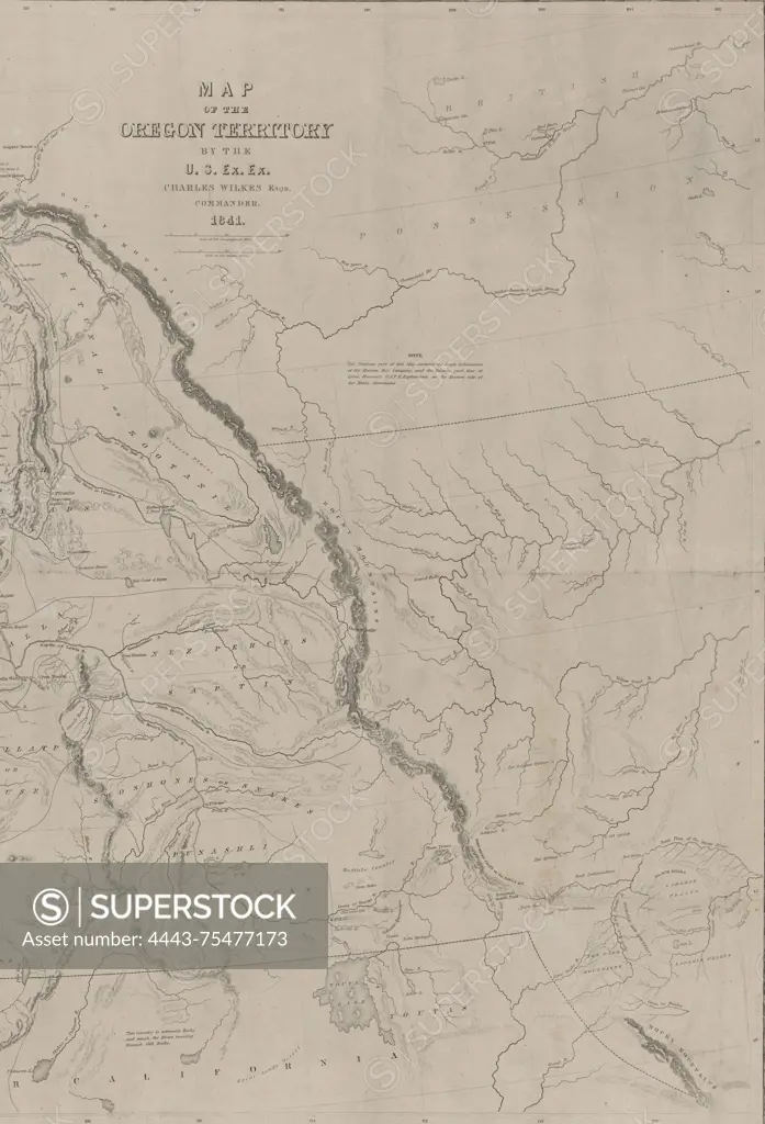
SuperStock offers millions of photos, videos, and stock assets to creatives around the world. This image of Map of the Oregon Territory, 1841, United States Exploring Expedition (1838-1842). Issued in Washington, D.C. by U.S. Ex. Ex. It depicts the Northwest and Pacific regions, including the Columbia River. The map measures 58 x 89 cm on a sheet of 65 x 97 cm by Artokoloro is available for licensing today.
Looking for a license?
Click here, and we'll help you find it! Questions? Just ask!
Click here, and we'll help you find it! Questions? Just ask!
DETAILS
Image Number: 4443-75477173Rights ManagedCredit Line:Artokoloro/SuperStockCollection:Artokoloro Model Release:NoProperty Release:NoResolution:3883×5700