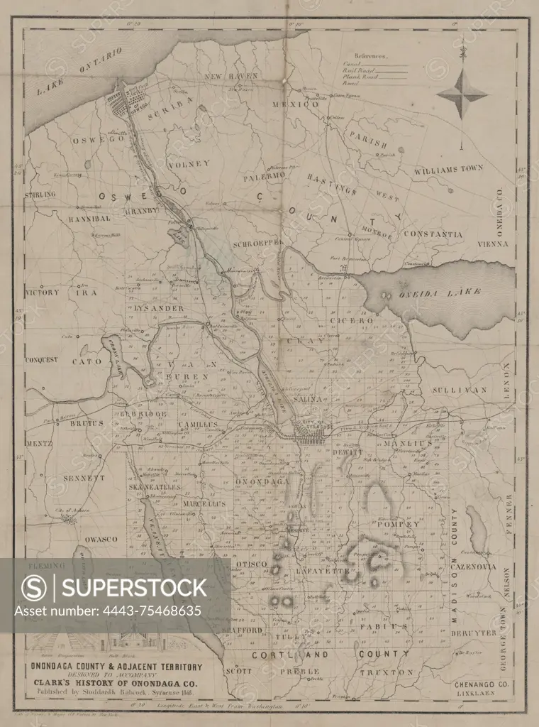
A map of Onondaga County and adjacent territory, designed to accompany Clark's History of Onondaga County, published in 1848 by Stoddard & Babcock in Syracuse, N.Y. The map measures 42 x 31 cm on a sheet of 49 x 38 cm and details the real property of the region, including various cities and towns within Onondaga County, New York
SuperStock offers millions of photos, videos, and stock assets to creatives around the world. This image of A map of Onondaga County and adjacent territory, designed to accompany Clark's History of Onondaga County, published in 1848 by Stoddard & Babcock in Syracuse, N.Y. The map measures 42 x 31 cm on a sheet of 49 x 38 cm and details the real property of the region, including various cities and towns within Onondaga County, New York by Artokoloro is available for licensing today.
Looking for a license?
Click here, and we'll help you find it! Questions? Just ask!
Click here, and we'll help you find it! Questions? Just ask!
DETAILS
Image Number: 4443-75468635Rights ManagedCredit Line:Artokoloro/SuperStockCollection:Artokoloro Model Release:NoProperty Release:NoResolution:4231×5700