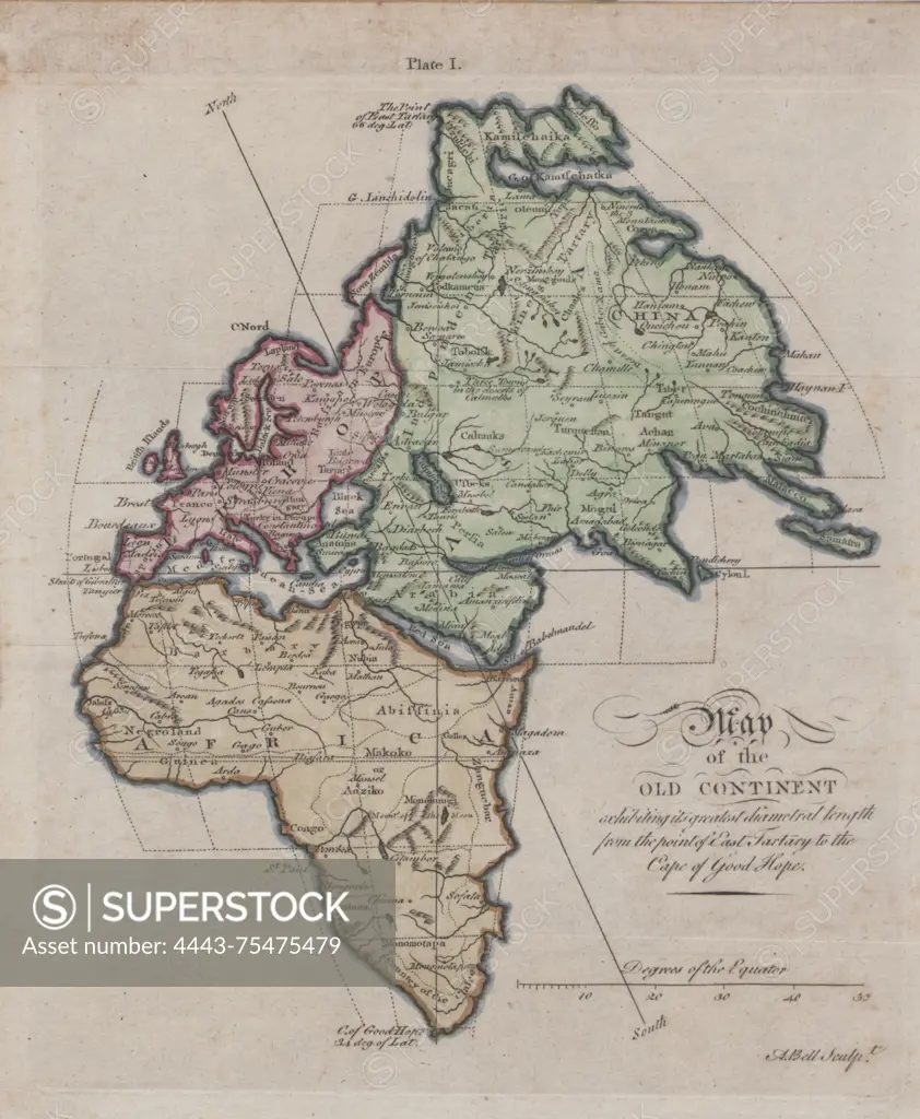
Map of the Old Continent exhibiting its greatest diametrical length from the point of East Tartary to the Cape of Good Hope, 1700 - 1799, (Questionable), S.l, Publisher, s.n., Europe Maps -- Early works to 1800, Asia Maps -- Early works to 1800, Africa Maps -- Early works to 1800, 1 map, Col., 25 x 21 cm
SuperStock offers millions of photos, videos, and stock assets to creatives around the world. This image of Map of the Old Continent exhibiting its greatest diametrical length from the point of East Tartary to the Cape of Good Hope, 1700 - 1799, (Questionable), S.l, Publisher, s.n., Europe Maps -- Early works to 1800, Asia Maps -- Early works to 1800, Africa Maps -- Early works to 1800, 1 map, Col., 25 x 21 cm by Artokoloro is available for licensing today.
Looking for a license?
Click here, and we'll help you find it! Questions? Just ask!
Click here, and we'll help you find it! Questions? Just ask!
DETAILS
Image Number: 4443-75475479Rights ManagedCredit Line:Artokoloro/SuperStockCollection:Artokoloro Model Release:NoProperty Release:NoResolution:2379×2891