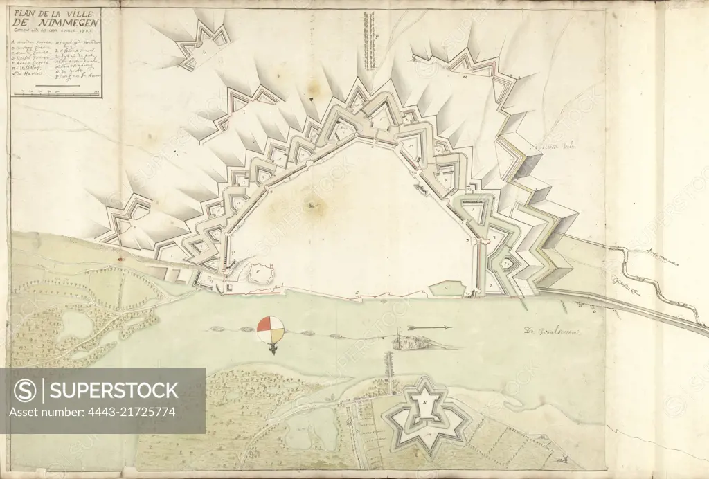
Map of Nijmegen, 1702, Samuel Du Ry de Champdoré, 1702, Map of the fortifications around the city of Nijmegen, 1702. Top left a cartouche with the title and legend A-P in Dutch. To the right a strip of paper has been affixed on which some lines have been drawn. Part of a collection of drawn plans of fortified towns in the Netherlands and surrounding countries at the time of the War of the Spanish Succession (part B)., draughtsman: Samuel Du Ry de Champdoré, Netherlands, 1702, paper, h 520 mm × w 845 mm
SuperStock offers millions of photos, videos, and stock assets to creatives around the world. This image of Map of Nijmegen, 1702, Samuel Du Ry de Champdoré, 1702, Map of the fortifications around the city of Nijmegen, 1702. Top left a cartouche with the title and legend A-P in Dutch. To the right a strip of paper has been affixed on which some lines have been drawn. Part of a collection of drawn plans of fortified towns in the Netherlands and surrounding countries at the time of the War of the Spanish Succession (part B)., draughtsman: Samuel Du Ry de Champdoré, Netherlands, 1702, paper, h 520 mm × w 845 mm by Artokoloro is available for licensing today.
Looking for a license?
Click here, and we'll help you find it! Questions? Just ask!
Click here, and we'll help you find it! Questions? Just ask!
DETAILS
Image Number: 4443-21725774Rights ManagedCredit Line:Artokoloro/SuperStockCollection:Artokoloro Model Release:NoProperty Release:NoResolution:6590×4458