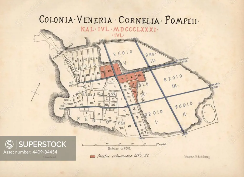
Map of the newly excavated Insulae (buildings) in Pompeii from 1874 to 1881. Map drawn by Presuhn and lithographed by J. G. Bach from Emil Presuhn's "Pompeji. Die Neuesten Ausgrabungen von 1874-1881," Weigel, Leipzig, 1882. German archeologist Presuhn (1844-1881) lived in Italy for eight years and, with Mr. Discanno and Miss Amy Butts, made exact copies of many wall paintings that are now lost.
This asset has restrictions and cannot be purchased online. Get in touch for more details.
SuperStock offers millions of photos, videos, and stock assets to creatives around the world. This image of Ancient Pompeii City Map: Explore the Historic Layout and Regions of Colonia Veneria Cornelia Pompeii – Uncover Archaeological Insights by Album/Florilegius/Album Archivo is available for licensing today.
Looking for a license?
Click here, and we'll help you find it! Questions? Just ask!
Click here, and we'll help you find it! Questions? Just ask!
DETAILS
Image Number: 4409-84454Rights ManagedCredit Line:Album/Florilegius/Album Archivo/SuperStockCollection:Album Archivo Contributor:Album / Florilegius Model Release:NoProperty Release:NoResolution:6081×4419