Map of the New York Wilderness and the Adirondacks, published in 1879 by G.W. & C.B. Colton & Co. The map, measuring 79 x 69 cm on a sheet of 82 x 72 cm, is hand-colored and depicts the Adirondack Mountains and the administrative and political divisions of New York State. It was engraved, printed, and published at 172 William St., New York
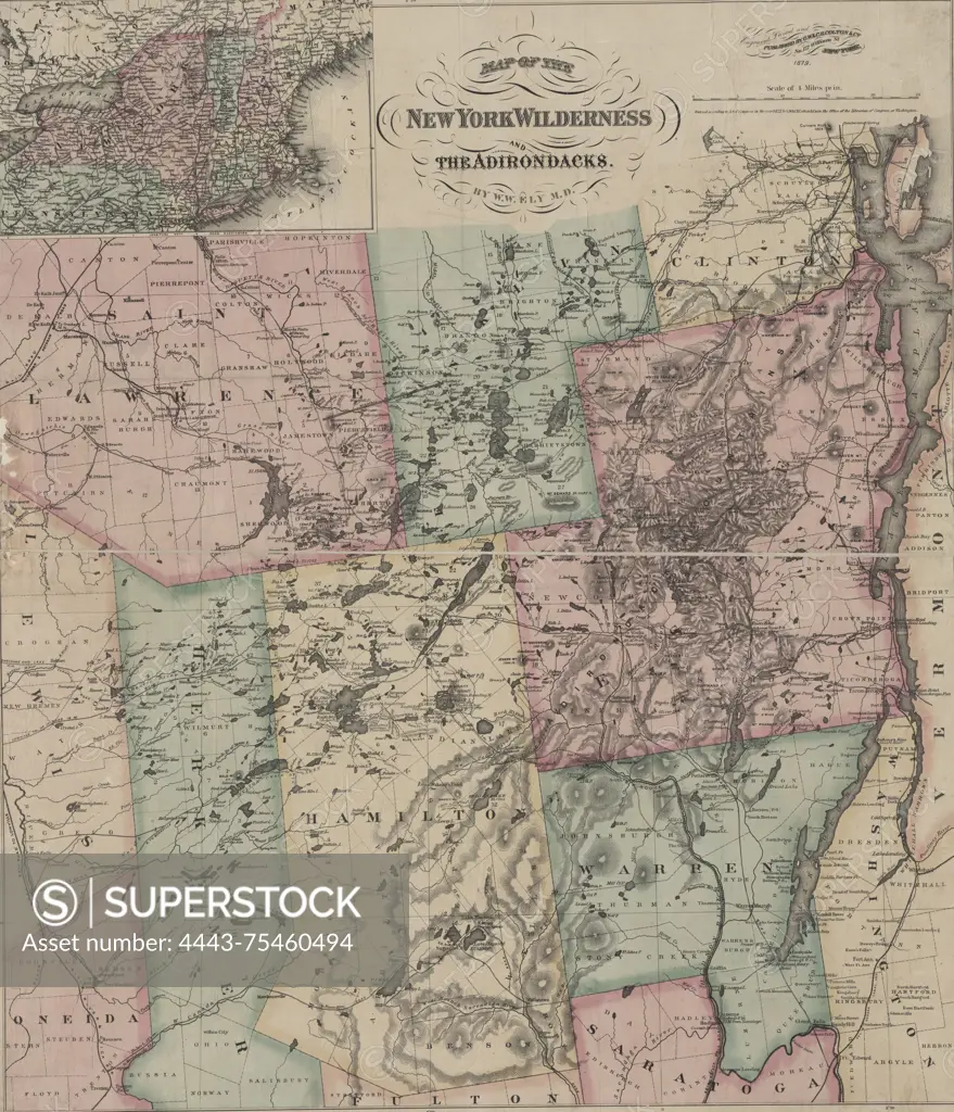
SuperStock offers millions of photos, videos, and stock assets to creatives around the world. This image of Map of the New York Wilderness and the Adirondacks, published in 1879 by G.W. & C.B. Colton & Co. The map, measuring 79 x 69 cm on a sheet of 82 x 72 cm, is hand-colored and depicts the Adirondack Mountains and the administrative and political divisions of New York State. It was engraved, printed, and published at 172 William St., New York by Artokoloro is available for licensing today.
Looking for a license?
Click here, and we'll help you find it! Questions? Just ask!
Click here, and we'll help you find it! Questions? Just ask!
DETAILS
Image Number: 4443-75460494Rights ManagedCredit Line:Artokoloro/SuperStockCollection:Artokoloro Model Release:NoProperty Release:NoResolution:4893×5700