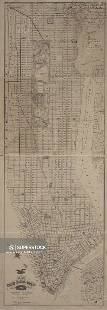
Map of New York City south of 132nd St., 1876, by M. Dripps. Issued in New York, published by M. Dripps with Ed. W. Welcke & Bro., Photo-Lithographers. The map features hand-colored details and measures 105 x 74 cm. It includes administrative and political divisions, local transit information, and piers in New York (State) and New York (N.Y.), specifically Manhattan
SuperStock offers millions of photos, videos, and stock assets to creatives around the world. This image of Map of New York City south of 132nd St., 1876, by M. Dripps. Issued in New York, published by M. Dripps with Ed. W. Welcke & Bro., Photo-Lithographers. The map features hand-colored details and measures 105 x 74 cm. It includes administrative and political divisions, local transit information, and piers in New York (State) and New York (N.Y.), specifically Manhattan by Artokoloro is available for licensing today.
Looking for a license?
Click here, and we'll help you find it! Questions? Just ask!
Click here, and we'll help you find it! Questions? Just ask!
DETAILS
Image Number: 4443-75458273Rights ManagedCredit Line:Artokoloro/SuperStockCollection:Artokoloro Model Release:NoProperty Release:NoResolution:3050×8811