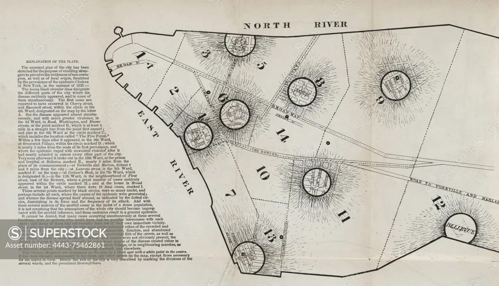
Map of New York City showing the spread of the cholera outbreak in the Summer of 1832, Frontispiece, 1833, New York, Publisher, Conner & Cooke; Boston, Lilly, Wait, & co., Cholera, 1 map 28 x 57 cm (11 x 22.5 inches) (unfolded)
SuperStock offers millions of photos, videos, and stock assets to creatives around the world. This image of Map of New York City showing the spread of the cholera outbreak in the Summer of 1832, Frontispiece, 1833, New York, Publisher, Conner & Cooke; Boston, Lilly, Wait, & co., Cholera, 1 map 28 x 57 cm (11 x 22.5 inches) (unfolded) by Artokoloro is available for licensing today.
Looking for a license?
Click here, and we'll help you find it! Questions? Just ask!
Click here, and we'll help you find it! Questions? Just ask!
DETAILS
Image Number: 4443-75462861Rights ManagedCredit Line:Artokoloro/SuperStockCollection:Artokoloro Model Release:NoProperty Release:NoResolution:5700×3278