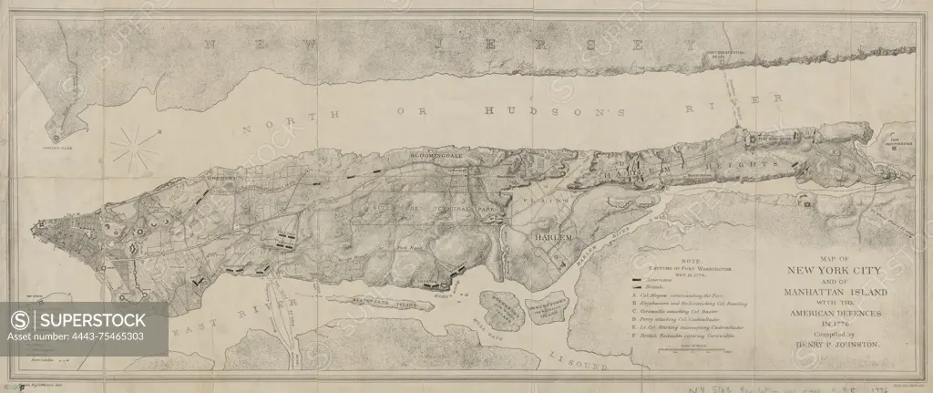
Map of New York City and Manhattan Island displaying the American defenses in 1776., 1878., Brooklyn, N.Y. Publisher, Long Island Historical Society. Historical context includes the American Revolution (1775-1783) in New York (N.Y.) and New York State., 1 map; 34 x 86 cm, sheet 40 x 93 cm. NYPL Map Division copy has accession number stamped in the lower left corner 62205
SuperStock offers millions of photos, videos, and stock assets to creatives around the world. This image of Map of New York City and Manhattan Island displaying the American defenses in 1776., 1878., Brooklyn, N.Y. Publisher, Long Island Historical Society. Historical context includes the American Revolution (1775-1783) in New York (N.Y.) and New York State., 1 map; 34 x 86 cm, sheet 40 x 93 cm. NYPL Map Division copy has accession number stamped in the lower left corner 62205 by Artokoloro is available for licensing today.
Looking for a license?
Click here, and we'll help you find it! Questions? Just ask!
Click here, and we'll help you find it! Questions? Just ask!
DETAILS
Image Number: 4443-75465303Rights ManagedCredit Line:Artokoloro/SuperStockCollection:Artokoloro Model Release:NoProperty Release:NoResolution:5700×2402