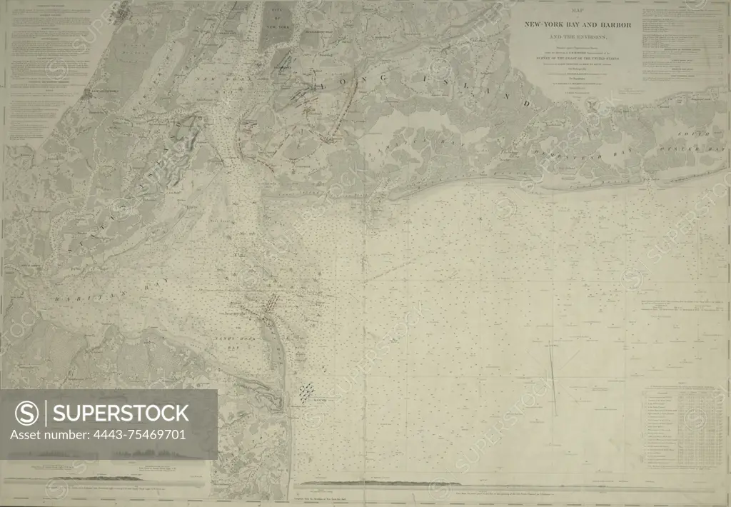
Map of New-York Bay and Harbor and the surrounding areas, featuring colored manuscript additions that indicate the positions of troops and fleets during the Battle of Long Island in 1776. Issued in 1845 by the United States Coast Survey. The map measures 61 x 88 cm and highlights historical details related to the New York Metropolitan Area, including areas of New York, New Jersey, and Long Island, set against the backdrop of the American Revolutionary War (1775-1783)
SuperStock offers millions of photos, videos, and stock assets to creatives around the world. This image of Map of New-York Bay and Harbor and the surrounding areas, featuring colored manuscript additions that indicate the positions of troops and fleets during the Battle of Long Island in 1776. Issued in 1845 by the United States Coast Survey. The map measures 61 x 88 cm and highlights historical details related to the New York Metropolitan Area, including areas of New York, New Jersey, and Long Island, set against the backdrop of the American Revolutionary War (1775-1783) by Artokoloro is available for licensing today.
Looking for a license?
Click here, and we'll help you find it! Questions? Just ask!
Click here, and we'll help you find it! Questions? Just ask!
DETAILS
Image Number: 4443-75469701Rights ManagedCredit Line:Artokoloro/SuperStockCollection:Artokoloro Model Release:NoProperty Release:NoResolution:4627×3210