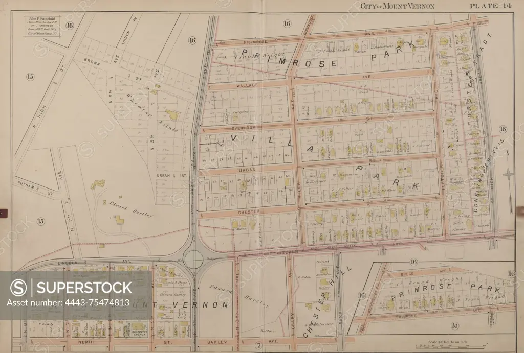
Map of Mount Vernon, Double Page Plate No. 14, bounded by Primorse Ave., Rich Ave., N. Oakley Ave., N. 8th Ave., Putnam St., and N. High St. Issued in 1899 by John F. Fairchild. Mount Vernon, N.Y. Relevant to real property in New York State, specifically in Mount Vernon and Pelham (Town), Westchester County, N.Y
SuperStock offers millions of photos, videos, and stock assets to creatives around the world. This image of Map of Mount Vernon, Double Page Plate No. 14, bounded by Primorse Ave., Rich Ave., N. Oakley Ave., N. 8th Ave., Putnam St., and N. High St. Issued in 1899 by John F. Fairchild. Mount Vernon, N.Y. Relevant to real property in New York State, specifically in Mount Vernon and Pelham (Town), Westchester County, N.Y by Artokoloro is available for licensing today.
Looking for a license?
Click here, and we'll help you find it! Questions? Just ask!
Click here, and we'll help you find it! Questions? Just ask!
DETAILS
Image Number: 4443-75474813Rights ManagedCredit Line:Artokoloro/SuperStockCollection:Artokoloro Model Release:NoProperty Release:NoResolution:6993×4721