Map of Minnesota, compiled from the latest authentic sources in 1885 by the Minnesota State Board of Immigration. The map, issued in St. Paul, Minn., features hand coloring and measures 54 x 45 cm on a sheet of 56 x 47 cm. It includes railroads and shows administrative and political divisions of the state
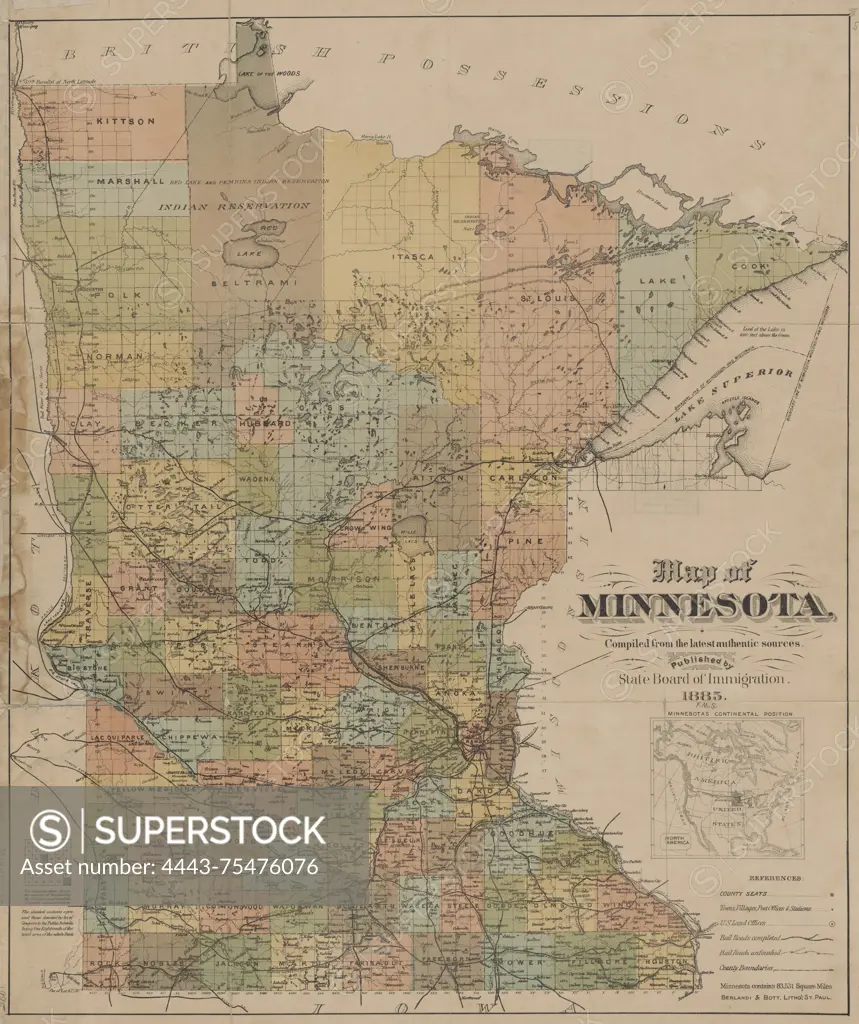
SuperStock offers millions of photos, videos, and stock assets to creatives around the world. This image of Map of Minnesota, compiled from the latest authentic sources in 1885 by the Minnesota State Board of Immigration. The map, issued in St. Paul, Minn., features hand coloring and measures 54 x 45 cm on a sheet of 56 x 47 cm. It includes railroads and shows administrative and political divisions of the state by Artokoloro is available for licensing today.
Looking for a license?
Click here, and we'll help you find it! Questions? Just ask!
Click here, and we'll help you find it! Questions? Just ask!
DETAILS
Image Number: 4443-75476076Rights ManagedCredit Line:Artokoloro/SuperStockCollection:Artokoloro Model Release:NoProperty Release:NoResolution:4783×5700